Canyonlands National Park
Tucked into the vast desert wilderness of southeastern Utah, Canyonlands National Park is a staggering landscape of water-carved rock, wind-swept mesas, and ancient cultural echoes. Just southwest of Moab and Arches National Park, Canyonlands stretches across 527 square miles, making it the largest national park in Utah—and arguably one of its most mysterious.
Founded in 1964, the park surrounds the dramatic confluence of the Green and Colorado Rivers, which together have sculpted one of the most visually arresting terrains in North America. Visitors often describe it as otherworldly: a place where time feels suspended, and where centuries of erosion have transformed solid stone into surreal spires, labyrinthine canyons, and sprawling plateaus.
But Canyonlands is far from monolithic. It’s a park of distinct zones, each with its own topography, character, and challenges. From the elevated views at Island in the Sky to the slot canyons of The Maze, this is a place where adventure unfolds layer by layer.
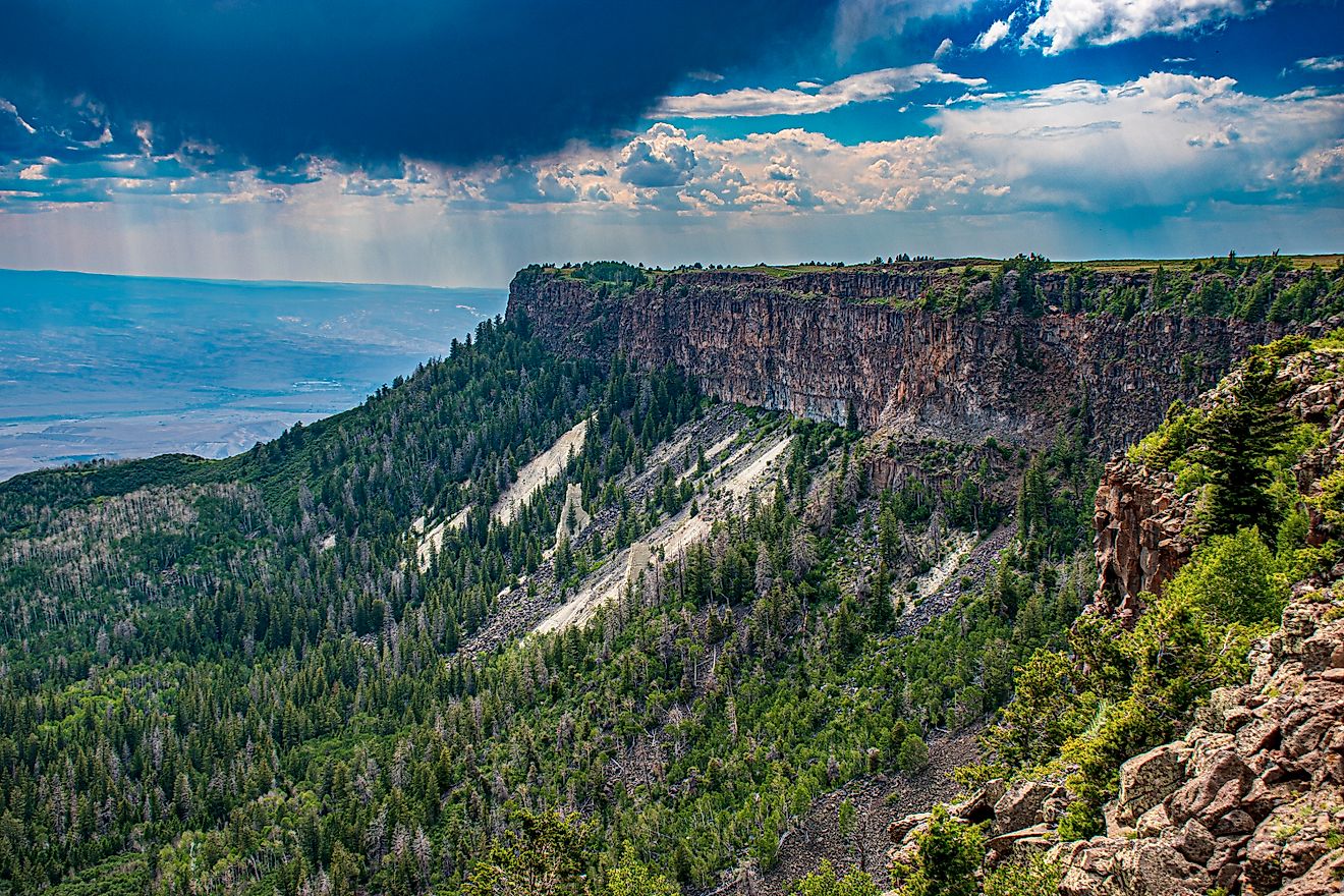
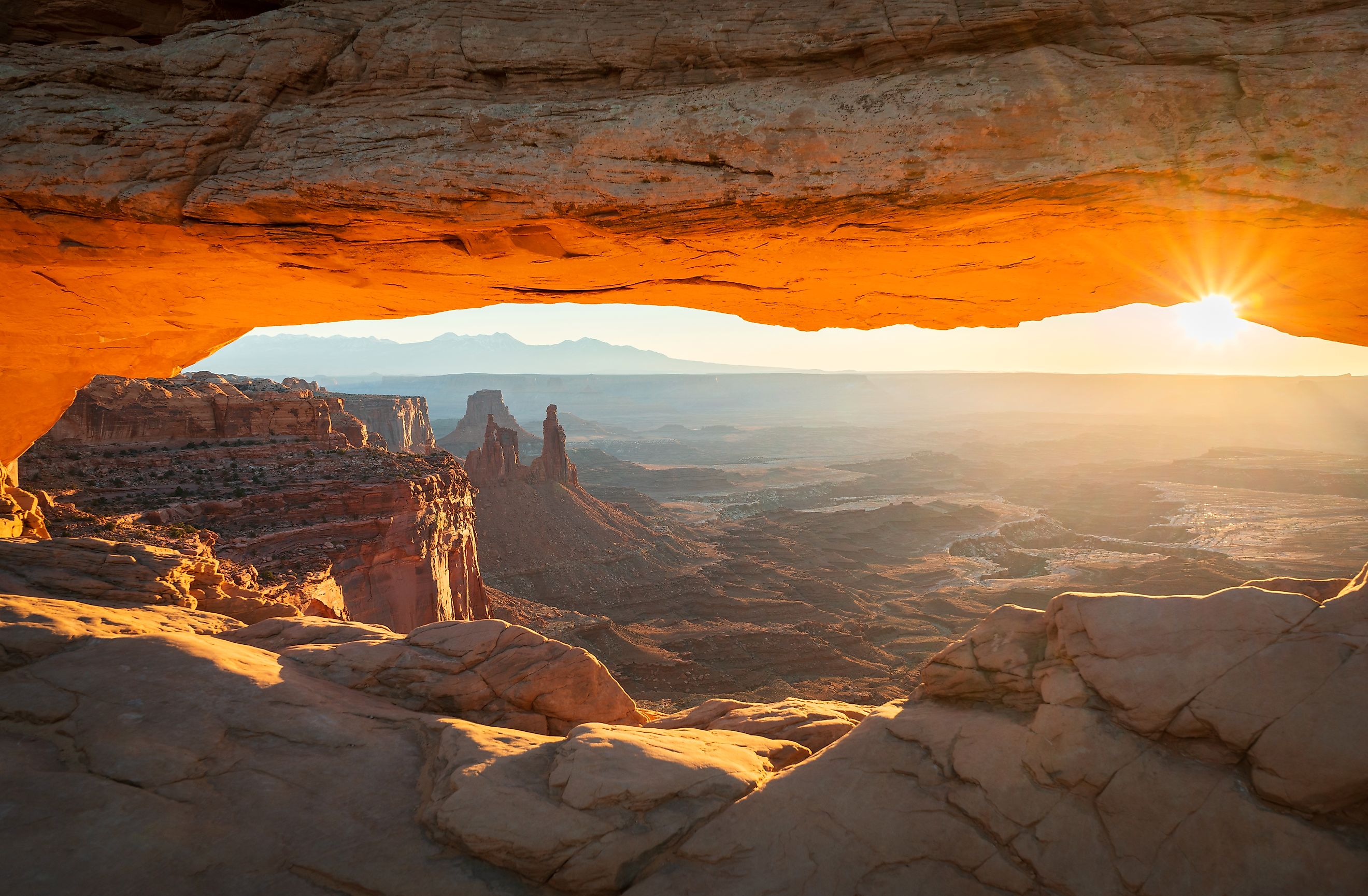
Canyonlands' Grand Balcony

If you’re visiting Canyonlands for the first time, the Island in the Sky district is your best introduction. This high desert mesa—accessible via a paved road from the north—sits at 6,000 feet above sea level, offering panoramic views of deep canyons carved by the Colorado and Green Rivers.
Stand at Grand View Point and gaze out at a landscape that stretches for miles in every direction. Below you, the rivers snake through trenches that look like scars across the Earth, forming canyons over 1,000 feet deep. Just beneath the mesa, the White Rim—a wide, nearly continuous terrace—circles the base like a hidden roadway. This rim is traversed by a rugged four-wheel-drive road, popular among off-roaders and backcountry campers.
One of Island in the Sky’s geological curiosities is the Upheaval Dome, a massive, 1.5-mile-wide crater with sharply folded rock walls. Scientists debate its origin—some argue it's a salt dome, others a meteorite impact site—but either way, it’s a dramatic display of geologic power.
Desert Towers and Ancient Dwellings

To the south lies The Needles, named for the towering banded spires of red and white sandstone that dominate the skyline. Unlike the sweeping vistas of Island in the Sky, the Needles District invites exploration at ground level. This is a hiker’s playground, filled with narrow canyons, bizarre rock formations, and hidden arches.
Two of the most famous formations are the Druid Arch and the Angel Arch, the latter soaring 150 feet into the air. These monumental rock structures feel more like natural cathedrals than desert features, casting shadows across the dry wash floors and juniper groves.
Adding to the district’s intrigue are remnants of ancient cultures. Tucked into canyon walls and alcoves are early Puebloan ruins, including the haunting Tower Ruin, a multi-level structure that clings to the cliffside. These dwellings offer a glimpse into the lives of people who lived here more than 800 years ago, surviving in one of the harshest climates in North America.
The Needles region is accessed by a paved road from the southeast and includes a visitor center, developed campgrounds, and some of the park’s most extensive trail systems. Still, despite its infrastructure, solitude is easy to find—especially if you hike beyond the first few miles of any trail.
Canyonlands’ Final Frontier

Canyonlands is often described as remote, but no part is more isolated—or more mystifying—than The Maze. Covering about 30 square miles, The Maze is a backcountry destination in the truest sense: rugged, hard to reach, and nearly impossible to navigate without a map, compass, and serious wilderness skills.
The region’s name is no exaggeration. The Maze is a web of sheer-walled, twisting canyons—some as deep as 600 feet—that loop back on themselves like nature’s own labyrinth. Reaching the Maze requires four-wheel-drive travel over dirt roads, and from there, most exploration is done on foot. Trails are faint, signage is minimal, and the terrain is demanding.
Bordered by the Green River to the northeast and the Colorado River to the southeast, the Maze is also the gateway to Cataract Canyon, a 14-mile stretch of ferocious whitewater formed where the two rivers meet. This part of the park is a favorite for experienced rafters seeking an adrenaline rush paired with jaw-dropping desert scenery.
Because of its difficulty, The Maze sees far fewer visitors than the other districts—perfect for adventurers seeking solitude and raw wilderness.
Horseshoe Canyon

Though detached from the rest of the park, Horseshoe Canyon—about 8 miles west of the main districts—is one of Canyonlands’ most culturally rich areas. It was officially added to the park in 1971 and is best known for the Great Gallery, a towering rock wall covered in prehistoric pictographs.
These Archaic-era artworks, some dating back over 2,000 years, depict human-like figures, animals, and abstract shapes in dark red pigment. Unlike the more common petroglyphs that are pecked into rock, the Great Gallery’s images are pictographs—painted with natural dyes and remarkably well-preserved given their age.
Reaching Horseshoe Canyon requires a strenuous hike, usually from a trailhead to the north, but the reward is a haunting, sacred landscape that feels frozen in time.
Rivers, Rock, and Time

Canyonlands is ultimately a park shaped by water. The Green and Colorado Rivers have, over millions of years, etched their signatures into sandstone, forming the park’s dramatic mesas, buttes, and gorges.
Float trips are popular, particularly the journey down to the rivers’ confluence, where calmer waters give way to the turbulent waves of Cataract Canyon. These river excursions offer an immersive view of the park’s sheer cliffs, hanging gardens, and sculpted rock walls—accessible only by boat.
In spring, wildflowers like desert primrose and evening primrose erupt across the landscape, adding bursts of color to the reds and ochres of the desert. Along the riverbanks, cottonwoods, tamarisks, and willows thrive in contrast to the arid uplands above.
Wildlife in a Land of Extremes

Canyonlands may appear desolate, but it's home to a surprising variety of wildlife. Desert bighorn sheep scale narrow canyon ledges with ease. Coyotes and foxes roam the scrublands, while mule deer graze in shaded pockets. Reptiles like collared lizards and side-blotched lizards are often seen basking on rocks.
Because of the harsh climate, many of these animals are most active at dawn and dusk. During the heat of the day, the desert becomes quiet—an eerie silence broken only by the wind.
Know Before You Go
| Category | Details |
|---|---|
| Location | Southeastern Utah, ~30 minutes southwest of Moab |
| Main Entrances | Island in the Sky (north), The Needles (southeast), The Maze (west, remote) |
| Best Time to Visit | Spring (April–May) and Fall (September–October) for mild temperatures |
| Summer Conditions | Very hot; daytime highs often exceed 100°F |
| Winter Conditions | Cold with occasional snow, especially in higher elevations |
| Park Size | 527 square miles |
| Districts | Island in the Sky, The Needles, The Maze, Horseshoe Canyon |
| Visitor Centers | Island in the Sky and The Needles |
| Permit Requirements | Required for backcountry camping, The Maze, and river trips |
| Accessibility | Island in the Sky: paved roads; The Maze: 4WD only; Horseshoe: hiking access |
| Popular Activities | Hiking, backpacking, 4WD driving, rafting, photography, stargazing |
| Wildlife to Spot | Bighorn sheep, mule deer, coyotes, lizards, foxes |
| Flora Highlights | Cottonwoods, tamarisks, spring wildflowers, willows near rivers |