Uncompahgre National Forest
High above western Colorado, where sunbaked mesas meet jagged, snow-dusted peaks, Uncompahgre National Forest rises as a breathtaking mosaic of landscapes. Covering more than 955,000 acres across eight counties, this public treasure blends arid plateau country with alpine heights, creating a playground for explorers, photographers, and anyone drawn to raw natural beauty.
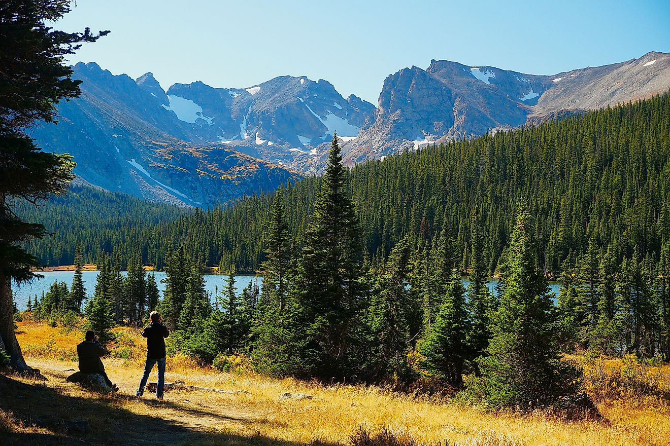
Rugged ridgelines, glacial basins, and rust-colored cliffs tell a story written in stone over millions of years. Ancient rivers carved canyons that now host waterfalls, and volcanic peaks rise like ancient sentinels against the sky. Wilderness areas such as Uncompahgre, Mount Sneffels, and Lizard Head protect high summits and remote habitats where wildlife thrives far from civilization.
A Land Shaped by Time

The geography of Uncompahgre reflects a history of monumental natural forces. Farther south, the northern San Juan Mountains climb above treeline, their granite peaks often dusted in snow. To the north, the Uncompahgre Plateau stretches across forested mesas and canyons, a stark contrast to the alpine highlands.
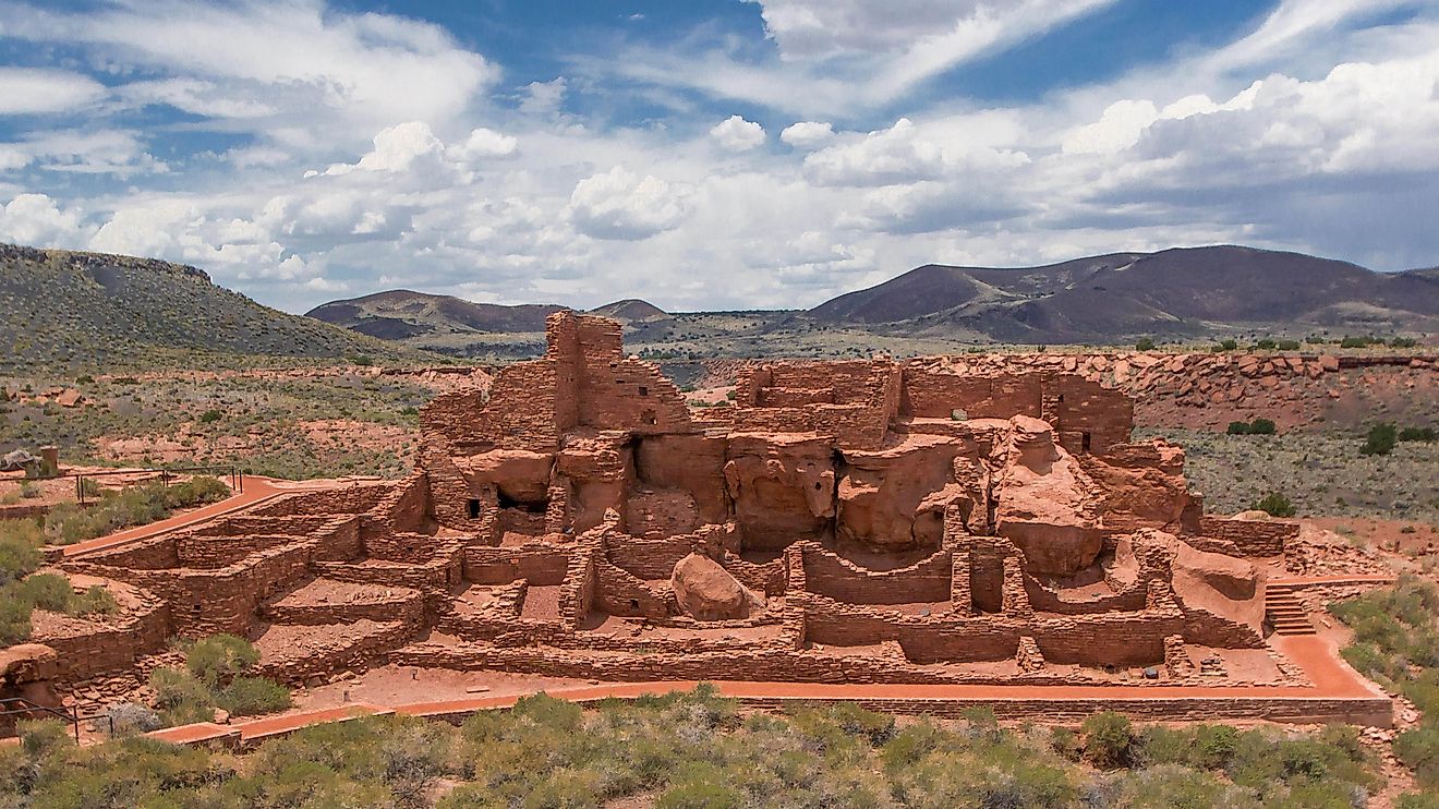
The forest’s name comes from the Ute language, interpreted as “dirty water” or “hot spring,” pointing to its geothermal history. Early roads trace the feverish mining rush of the late 1800s, and dinosaur tracks near Ouray hint at life from millions of years earlier. Waterfalls plunge dramatically from cliffs, and scenic highways wind along sheer drops, offering a constant reminder of the land’s dynamic energy.
Two Worlds in One Forest

Uncompahgre spans Montrose, Mesa, San Miguel, Ouray, Gunnison, Hinsdale, San Juan, and Delta Counties. The forest’s headquarters are in Delta, but its reach covers terrain as diverse as any in the state.
Key Landscape Zones:
| Zone | Description | Flora & Fauna |
|---|---|---|
| Uncompahgre Plateau | Forested mesas and canyons | Pinyon pine, juniper, mule deer |
| Northern San Juan Mountains | High alpine peaks | Aspen, subalpine fir, mountain goats |
| High Country Lakes & Streams | Alpine lakes, waterfalls | Trout, elk, black bears |
Pinyon and juniper woodlands transition into aspen groves, then into subalpine fir forests and tundra above treeline. This variety makes Uncompahgre a microcosm of Colorado’s natural diversity, attracting hikers, scientists, and photographers.
A Forest with Deep Roots

Uncompahgre National Forest was established on June 14, 1905, as part of early federal conservation efforts. It later merged administratively with Grand Mesa in 1954 and Gunnison National Forest in 1973. Today, the combined GMUG National Forests operate from Delta, with active ranger stations in Montrose, Norwood, and Gunnison.
Human history is etched into the land. Ghost towns, wagon roads, and early mining structures echo past industries. Modern stewardship focuses on conservation, trail maintenance, and habitat protection.
Wilderness Areas That Captivate

Three federally designated wilderness areas anchor the forest:
-
Uncompahgre Wilderness: Surrounding Uncompahgre Peak (14,321 feet), this area offers rugged summits, alpine lakes, and open tundra.
-
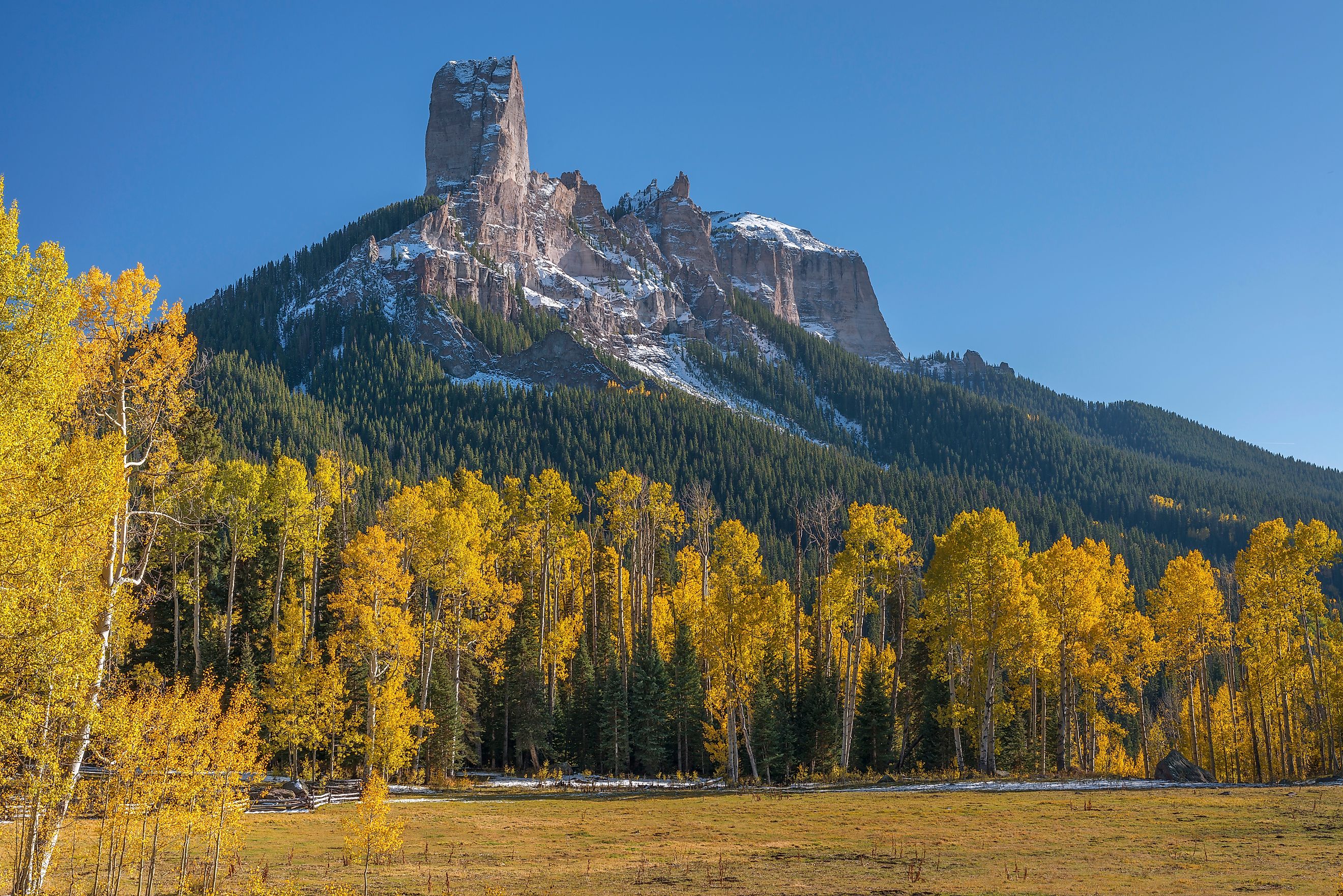
Mount Sneffels Wilderness: Featuring jagged spires and cirques, this iconic peak draws climbers and photographers from across the world.
-
Lizard Head Wilderness: Named for a volcanic spire resembling an ancient creature, this area blends high alpine terrain with steep canyons.
Each wilderness provides a unique taste of Colorado’s high country, from open tundra and volcanic formations to dense forests.
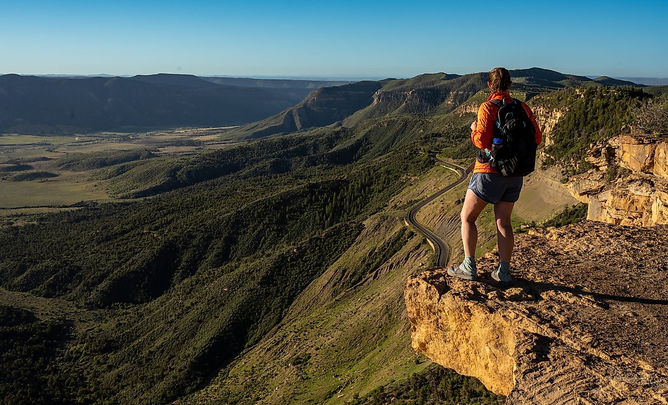
Roads That Inspire Awe

Scenic drives through Uncompahgre National Forest are legendary. Paved routes, historic byways, and rugged backroads reveal ever-changing landscapes:
Must-See Drives:
-
Million Dollar Highway (US 550): Hairpin turns and sheer cliffs connect Ouray and Silverton.
-
San Juan Skyway: Looping through Telluride, Dolores, and Durango, this route is famed for its panoramic beauty.
-
Alpine Loop: A mix of old mining roads links Lake City, Ouray, and Silverton above 12,000 feet.
-
Unaweep-Tabeguache Scenic Byway: Red sandstone cliffs and sweeping plateaus evoke the desert southwest.
Gravel routes like Owl Creek Pass offer cinematic vistas and a direct connection to nature, with landscapes that have appeared in classic Western films.
Trails, Lakes, and Alpine Adventures

Adventure grows off the asphalt. Trails and dirt roads often follow routes forged during the mining boom of the 1800s, now perfect for hiking, horseback riding, and off-road exploration.
-
Yankee Boy Basin: Wildflowers, waterfalls, and mining relics above Ouray.
-
Engineer Pass: Rugged high-country terrain with panoramic views.
-
Trout Lake: Alpine lake framed by mountains along the San Juan Skyway.
Recreation matches the landscape’s diversity. Jeepers, hikers, photographers, and wildlife enthusiasts all find terrain suited to their passions.
A Prehistoric Connection

Uncompahgre’s story stretches back to the Jurassic. The West Gold Hill Dinosaur Track Site near Ouray, acquired by the GMUG National Forests in 2024, features 134 fossilized sauropod footprints, including the only known 270-degree loop of its kind.
This site preserves behavior as well as presence, revealing how a single massive dinosaur turned in a prehistoric floodplain. It is the most continuous trackway ever discovered for this species, expanding the forest’s natural history beyond human memory.
Water, Rock, and Sky

Uncompahgre thrives on contrasts. Arid plateaus intersect with alpine streams, waterfalls drop into fertile valleys, and cliffs glow in pink and orange sunsets.
Spotlight Sites:
-
Bridal Veil Falls, Telluride: Colorado’s tallest free-falling waterfall at 365 feet.
-
Trout Lake: Still waters mirror surrounding peaks.
-
Hidden Creeks & Alpine Lakes: Offer serene spots for reflection amid grandeur.
Water, rock, and sky interact to create a constantly shifting spectacle, from quiet alpine ponds to roaring falls.
Human Imprint on a Wild Land

Mining shaped roads, towns, and infrastructure, yet the forest remains wild. Modern conservation balances recreation with ecosystem protection. Projects include:
-
Watershed restoration
-
Trail maintenance
-
Wildlife habitat management
-
Protection of paleontological sites
These efforts ensure the forest can be enjoyed responsibly and remain resilient for generations.
Seasons That Transform

Uncompahgre changes dramatically with each season:
-
Summer: Wildflowers bloom and trails reopen, plateaus glimmer under the sun.
-
Autumn: Aspens create rivers of gold across the slopes.
-
Winter: Snow blankets high country, leaving canyons quiet and crisp.
-
Spring: Melting snow swells streams, returning life to alpine meadows.
Wildlife adapts to each change. Elk, black bears, mountain lions, and golden eagles navigate forests, meadows, and peaks throughout the year.
Where Time and Terrain Collide

Uncompahgre National Forest resists a single definition. It is part desert, part alpine, and part prehistoric laboratory. Peaks touch the clouds while plateaus stretch toward Utah’s red rocks. It holds the marks of ancient rivers, volcanic activity, glaciers, and dinosaurs alongside human history.
The forest’s magnetic pull comes from its contrasts and its stories. Here, wilderness continues to command respect, beauty appears at every turn, and the past and present coexist across mountains, canyons, and valleys. Each road, trail, and creek offers a chance to step into Colorado’s timeless grandeur.
Quick Facts
| Feature | Details |
|---|---|
| Location | Western Colorado, spanning eight counties |
| Size | 955,229 acres (1,492.55 sq mi) |
| Established | June 14, 1905 |
| Wilderness Areas | Uncompahgre, Mount Sneffels, Lizard Head |
| Administered With | Grand Mesa and Gunnison National Forests |
| Headquarters | Delta, Colorado |
| Key Attractions | Million Dollar Highway, Bridal Veil Falls, Trout Lake, West Gold Hill Dinosaur Trackway |
| Highest Point | Uncompahgre Peak (14,321 ft) |