Haleakalā
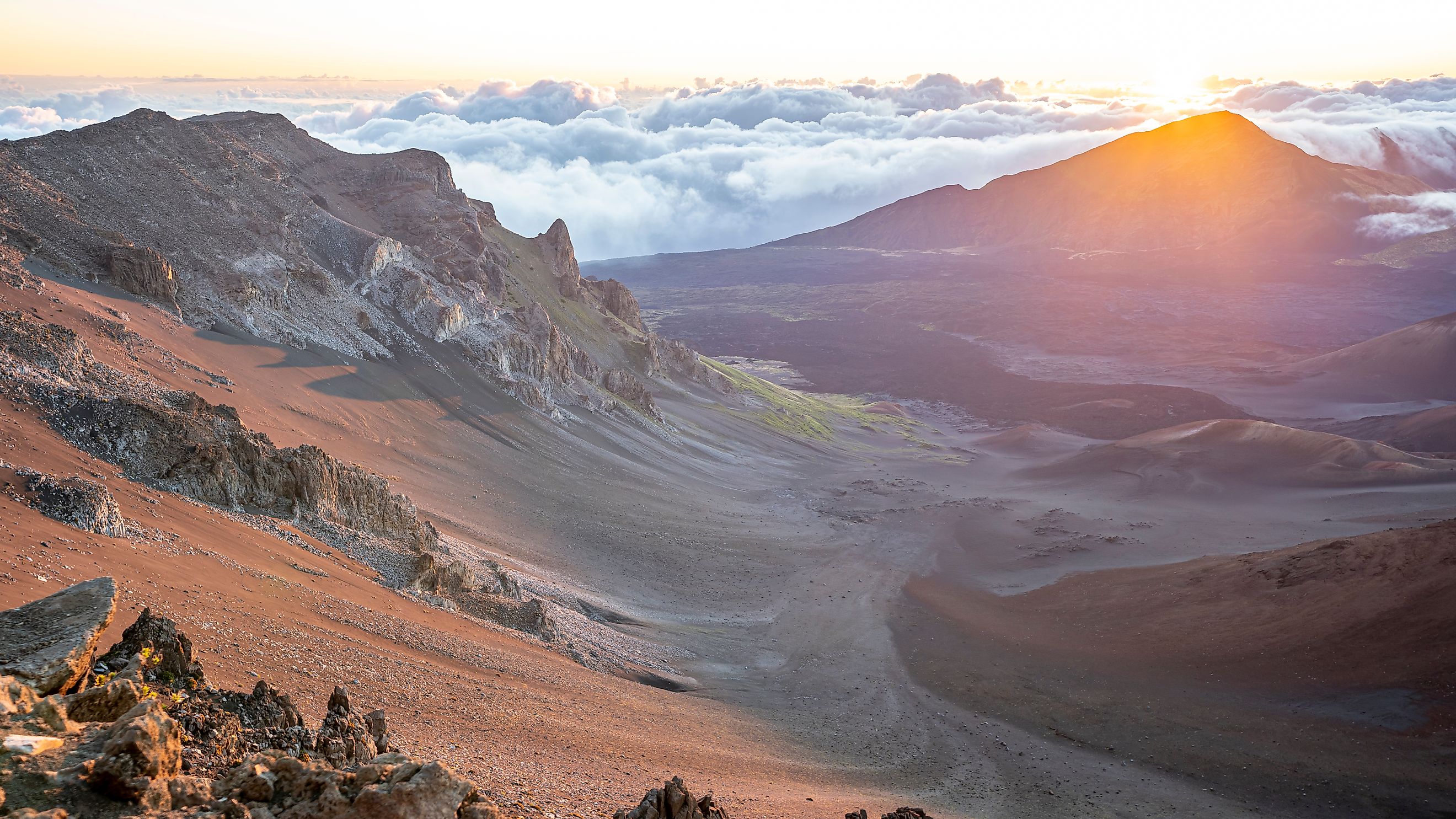
Perched on the Hawaiian island of Maui, Haleakalā is a breathtaking volcanic wonder that dominates the landscape with its immense shield-like form. This towering volcano, whose name means "House of the Sun" in Hawaiian, is not just a geological marvel but also a place of deep cultural significance and scientific intrigue. From its ancient eruptions to its role in Hawaiian mythology, Haleakalā’s story is as vast and complex as the crater that crowns its summit.
The Volcanic History of Haleakalā
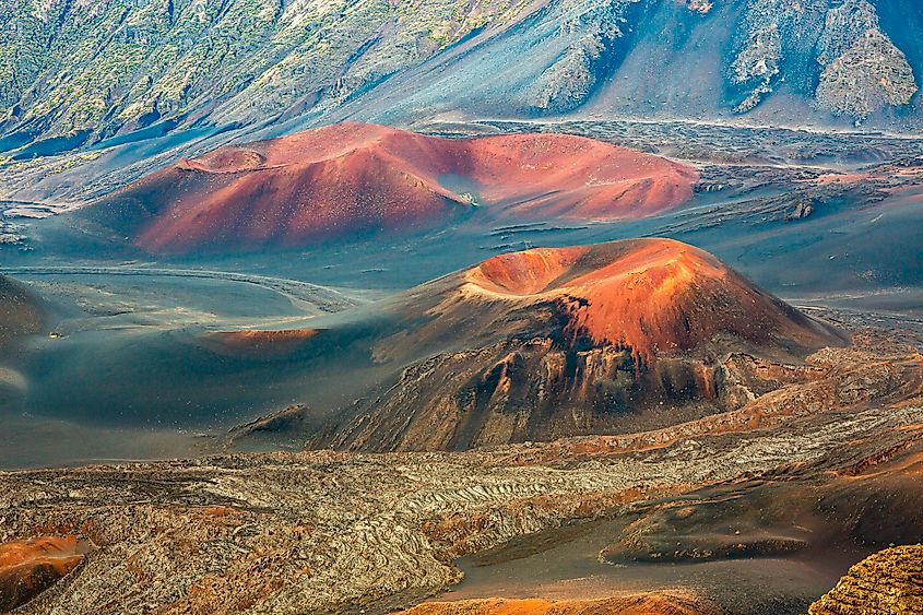
Though Haleakalā is often referred to as a dormant volcano, its past tells a different story. Geological evidence suggests that at least 10 eruptions have occurred in the past 1,000 years, with the most recent taking place sometime between 1480 and 1600. Its long history of activity and relatively recent eruptions indicate that Haleakalā is not extinct—it will erupt again in the future.
The volcano began forming about two million years ago, rising from the ocean floor through a series of lava flows. Today, it stands at an impressive 10,023 feet above sea level, though the majority of its mass—about 97%—remains hidden beneath the ocean. With a total volume of 30,000 cubic kilometers, Haleakalā is one of the largest volcanic structures in the Hawaiian archipelago.
For the past 30,000 years, volcanic activity on Haleakalā has been concentrated along the southwest and east rift zones. This network of fissures and vents extends from La Perouse Bay on the southwest flank through Haleakalā Crater and continues eastward beneath the ocean as Haleakalā Ridge, one of the longest rift zones in the Hawaiian Islands. This area is considered the highest risk zone for future lava flows and ash eruptions.
A Landscape Shaped by Time
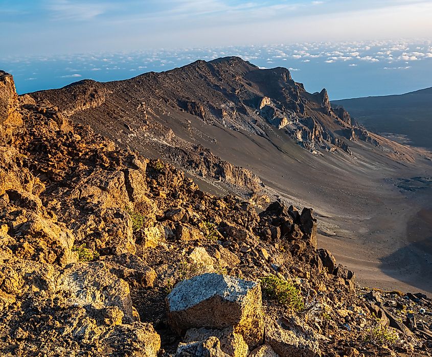
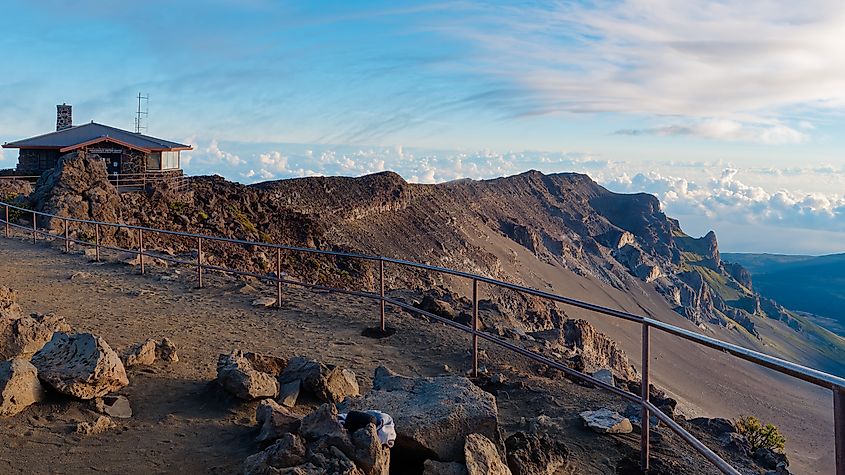
One of the most awe-inspiring features of Haleakalā is its massive summit crater, one of the largest dormant volcanic craters in the world. It measures 20 miles in circumference and features steep walls that, in places, rise more than 2,500 feet above the crater floor.
Unlike typical volcanic calderas, which form through explosive eruptions, Haleakalā’s crater is primarily an erosional feature. Over thousands of years, rain and wind carved deep valleys into the mountain’s summit, eventually merging to create the broad depression seen today. Two large gaps in the crater’s rim—the Ke‘anae and Kaupo valleys—allow lava to flow toward the ocean when eruptions occur.
Inside the crater, the landscape is a mix of forests, desert terrain, and grassy meadows, creating a surreal environment where varicolored cinder cones rise up to 600 feet high, remnants of past eruptions. The crater’s floor covers approximately 19 square miles and includes a small lake along with rare plant and animal species found nowhere else on Earth.
Haleakalā’s Diverse Climate and Terrain
Haleakalā’s towering elevation creates dramatic variations in climate and vegetation. The volcano’s northern and eastern slopes, exposed to moisture-laden trade winds, receive significant rainfall and support lush rainforests and thriving ecosystems. In contrast, the southern and western slopes lie in the mountain’s rain shadow, making them dry, arid landscapes with sparse vegetation.
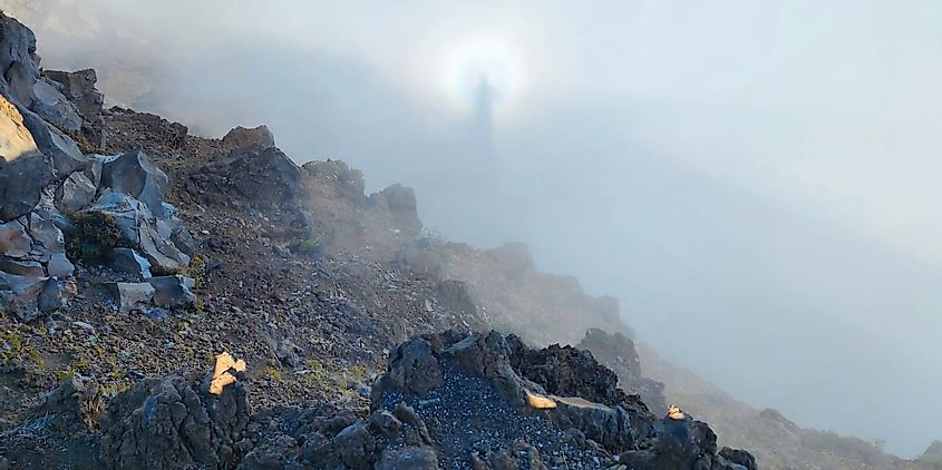
At sunrise, a breathtaking cloud inversion phenomenon occurs as trade-wind clouds drift over the low eastern rim of the crater, pooling within the summit depression. This spectacle sometimes produces a rare optical illusion known as the Brocken Bow, where an observer’s magnified shadow appears projected onto the mist, surrounded by a halo of rainbow-like colors.
Cultural Significance
Haleakalā is not only a geological wonder but also a place of immense spiritual and cultural importance to Native Hawaiians. According to Hawaiian legend, the demigod Māui stood atop the volcano and lassoed the Sun, forcing it to slow its journey across the sky. This act, intended to lengthen daylight hours, gave rise to the mountain’s name: "House of the Sun."
For centuries, the slopes and summit of Haleakalā have been considered sacred land, with ancient Hawaiian temples (heiau) and burial sites scattered throughout the region. Many Hawaiians still visit the summit to offer prayers and connect with their ancestors, reinforcing the deep spiritual bond between the land and its people.
Haleakalā National Park

Recognizing its ecological and cultural significance, Haleakalā was designated as part of Hawai‘i National Park in 1916 and later established as a separate entity in 1961. Covering 47 square miles, Haleakalā National Park includes the summit crater, the Kīpahulu Valley, and the ʻOheʻo Gulch area, home to stunning waterfalls and natural pools.
Visitors to the park can experience a range of breathtaking landscapes, from subtropical rainforests filled with rare native birds to Mars-like volcanic terrain dotted with lava formations. The park is also home to Science City, a research complex on the crater rim that hosts astrophysical studies conducted by organizations such as the U.S. Department of Defense, the University of Hawai‘i, and the Smithsonian Institution.
Will Haleakalā Erupt Again?
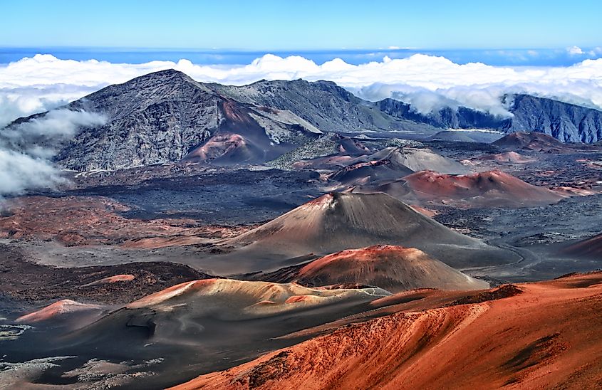
Although Haleakalā is classified as dormant, its geologic history suggests that future eruptions are likely. Scientists monitor the volcano for signs of activity, particularly along the southwest and east rift zones, where recent lava flows have occurred. The most recent eruptions, between 1480 and 1600, remind us that the volcano remains capable of awakening.
While there are no immediate signs of an eruption, ongoing monitoring by the U.S. Geological Survey (USGS) helps to track any changes in seismic activity or gas emissions. If an eruption were to occur, it would likely follow patterns observed in previous events—localized lava flows rather than explosive outbursts.