Finger Lakes National Forest
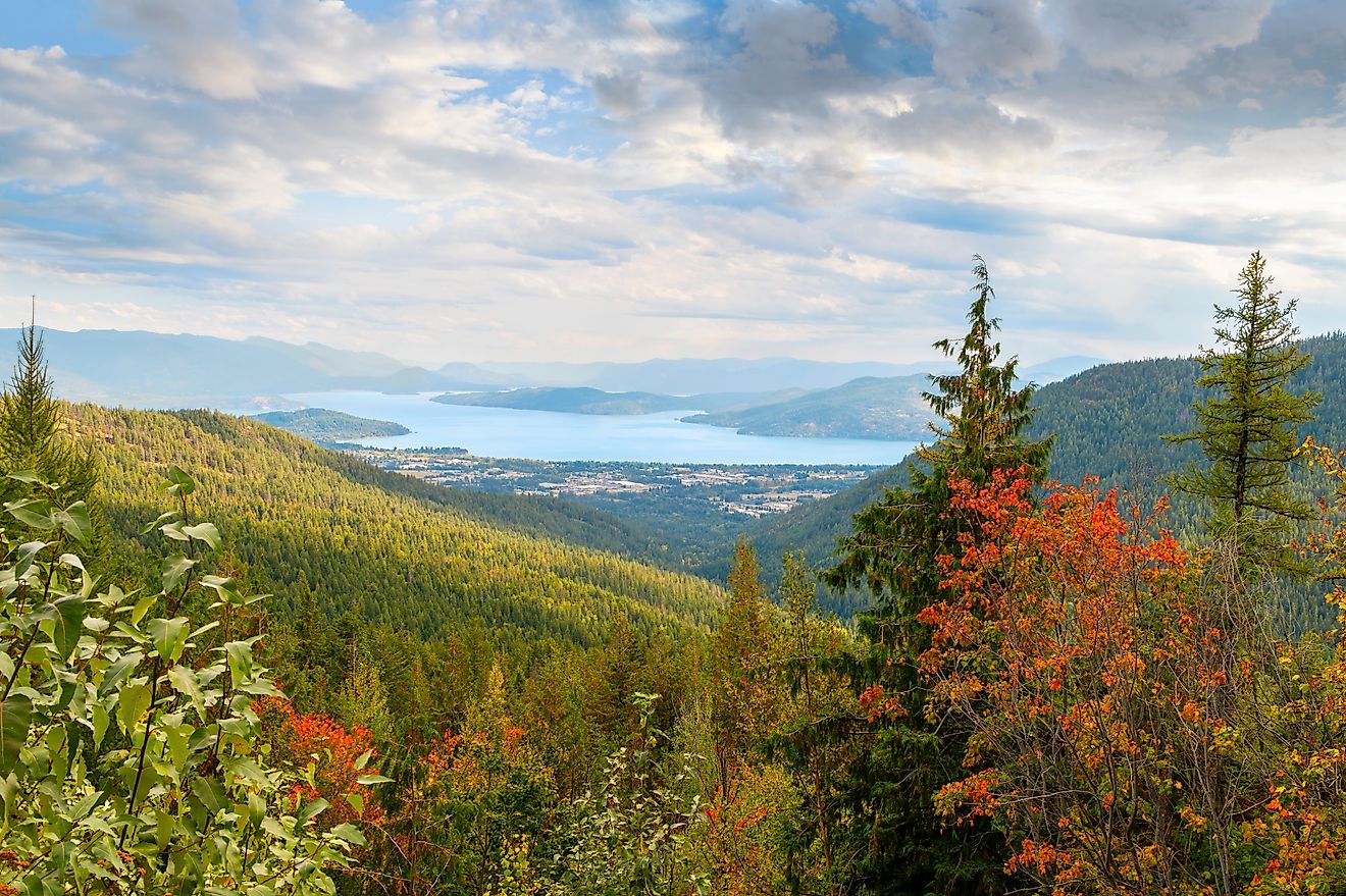
If you have ever driven between Seneca Lake and Cayuga Lake in New York, you may have passed one of the most unique public lands in the Northeast without even realizing it. The Finger Lakes National Forest is New York’s only national forest, a rare expanse of open pastures, hardwood forests, and rolling hills that feels both historic and wild. It is 16,212 acres of beauty and history tucked along a ridge known locally as “the backbone” between two of the most famous Finger Lakes.
The forest offers more than just scenic views. It is a living example of how the land has evolved over centuries, from Haudenosaunee hunting territory to farmland, and finally to a protected multi-use public space. Whether you are drawn by its history, wildlife, or trails, this national forest offers an experience that feels distinctly different from the surrounding wine country and small towns.
A National Forest with a Unique Role in New York

Finger Lakes National Forest in New York. Editorial credit: U.S. Forest Service, public domain via Wikimedia Commons
Unlike the Adirondacks or Catskills, which are dominated by state-owned land, the Finger Lakes region has relatively little public land. The Finger Lakes National Forest is the only federally managed national forest in New York, and it serves a variety of purposes. It preserves historic sites, protects wildlife habitats, supports grazing for local livestock owners, and provides more than 30 miles of trails for outdoor recreation.
Its mix of open pasture, second-growth woodland, and shrubland gives it a character that is more reminiscent of western national forests than the dense forests often associated with the Northeast. Cattle still graze in summer, hikers can walk through both meadows and deep woods, and birdwatchers can find rare grassland and shrubland species that are disappearing elsewhere in the state.
The Early Story: From Haudenosaunee Hunting Grounds to Open Fields

The land we now call the Finger Lakes National Forest was part of the seasonal hunting and gathering territory of the Haudenosaunee for hundreds of years. The Seneca and Cayuga Nations, two of the Six Nations of the Haudenosaunee Confederacy, lived around the lakes that bear their names. Within the current forest boundaries, there were no large year-round villages, partly due to the lack of dependable water sources and the nature of the soils. However, the area’s original forests of pine, oak, maple, and hickory provided excellent hunting and nut-gathering grounds.
After the American Revolution, the region’s history took a dramatic turn. The Haudenosaunee had allied with the British during the war, and the resulting Sullivan Campaign of 1779 destroyed villages and crops throughout the region. In the aftermath, much of the land was divided into “military lots” of 600 acres each, given to Revolutionary War veterans as payment for their service.
Farmland, Decline, and Abandonment

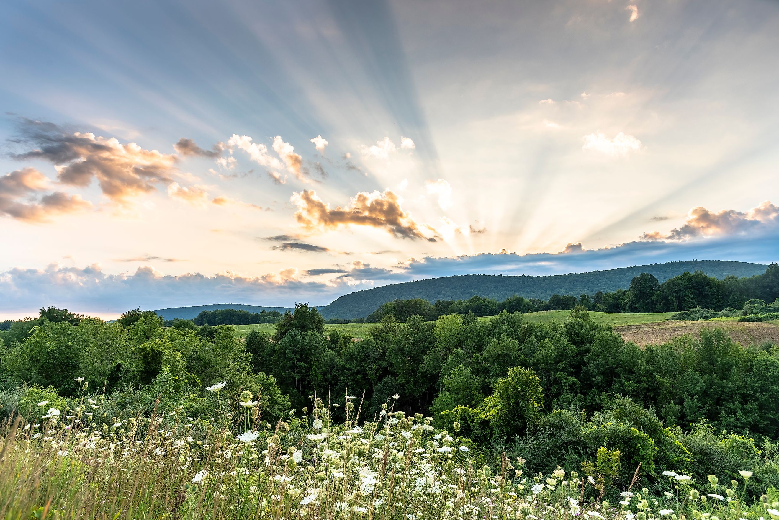
Finger Lakes National Forest farmland and rolling hills. Editorial credit: SlapTheWorld via Wikimedia Commons
By the early 19th century, the forested hills had been cleared for agriculture. Hay, buckwheat, and other small grains were grown to feed a growing market in cities like New York. Farmers prospered for a time, but by the mid-1800s, several challenges hit the region. Soil fertility declined, western farms began producing grain more cheaply, and the demand for horse feed dropped with the rise of mechanized transportation.
The result was gradual abandonment. By the early 20th century, much of the land had been overworked and could no longer sustain farming. Between 1890 and the Great Depression, large tracts were left empty, and erosion became a major problem.
The Federal Government Steps In

During the 1930s, federal programs like the Bankhead-Jones Farm Tenant Act allowed the government to purchase failing farms. Between 1938 and 1941, more than 100 farms in the region were acquired by the Resettlement Administration. Families were relocated to more productive land or new jobs, and the abandoned fields began to recover.
This new federally owned land was called the Hector Land Use Area. Initially managed by the Soil Conservation Service, it was used to experiment with soil restoration, pasture management, and sustainable grazing. Trees were planted to prevent erosion, and open fields were maintained for livestock grazing through the Hector Cooperative Grazing Association.
Becoming a National Forest

By the 1950s, many of the conservation goals for the Hector Land Use Area had been met, but the public had grown attached to the land as a place for recreation and resource use. In 1954, management was transferred to the U.S. Forest Service. Local residents strongly opposed any plans to sell the land, and in 1985, Congress officially designated it as the Finger Lakes National Forest.
Today, the forest is still managed as part of the Green Mountain National Forest system, with offices in Rutland, Vermont. It continues to balance grazing, recreation, habitat protection, and historic preservation.
What to See and Do in the Finger Lakes National Forest

Finger Lakes National Forest trail sign. Editorial credit: SlapTheWorld via Wikimedia Commons
Hiking and Trails
The forest has over 30 miles of interconnected trails that cross open pastures, wooded hills, gorges, and ravines. The Interloken Trail is the most popular, running 12 miles from north to south and offering a mix of meadows, woodlands, and ridge-top views. Hikers can also explore shorter loops, some of which connect to the historic North Country National Scenic Trail.
Wildlife Watching
The forest’s diverse habitats make it a prime spot for birdwatching. Visitors may spot grassland birds like bobolinks, Henslow’s sparrows, and northern harriers, as well as woodland species such as scarlet tanagers and ruffed grouse. Deer, wild turkeys, red foxes, and even bobcats roam the area. Ponds and wetlands also attract wood ducks and beavers.
Camping
Camping is available at designated sites such as the Blueberry Patch Campground, as well as in certain backcountry areas. The forest is open year-round, and winter camping is allowed for the adventurous.
Winter Activities
In winter, the trails transform into routes for cross-country skiing, snowshoeing, and snowmobiling. The rolling terrain makes for scenic outings without extreme elevation gains.
Horseback Riding and Biking
Many of the trails are open to horseback riders and mountain bikers, especially in the warmer months. Wide grassy lanes and old farm roads make for pleasant rides.
Historic Landmarks and Hidden Stories

While much of the forest looks natural today, there are reminders of its farming past. Old stone walls, cellar holes, and fence lines mark where farmsteads once stood. These are protected under federal law and are a quiet testament to the families who once worked the land.
One unique site is the Queen’s Castle at the former Camp Fossenvue, which was added to the forest in 1996 and is listed on the National Register of Historic Places. The camp was an important gathering place for progressive women in the late 19th century, and its stone building remains a point of interest for visitors.
A Forest That Feels Different

What sets the Finger Lakes National Forest apart is its open landscape. Instead of endless tree cover, you will find broad pastures where cattle graze in summer, framed by the blue waters of Seneca and Cayuga Lakes in the distance. The blend of grasslands, shrublands, and woodlands creates an ecosystem that is rare in the Northeast, making it both ecologically important and visually distinctive.
It is also a place where you can see multiple uses of public land in action. Grazing programs, habitat restoration, timber management, and recreation all happen here, often side by side. It is not wilderness in the untouched sense, but it is wild in the way nature and history coexist.
Planning Your Visit
-
Location: Between Seneca and Cayuga Lakes, nearest town is Hector, New York.
-
Size: Approximately 16,212 acres.
-
Trails: Over 30 miles for hiking, horseback riding, biking, skiing, and snowshoeing.
-
Camping: Blueberry Patch Campground and designated backcountry areas.
-
Best Seasons: Spring for wildflowers, summer for open pasture views, fall for foliage, and winter for snow sports.


.jpg)