7 US Lakes With Sunken Towns Beneath Them
Across the United States, entire towns have vanished underwater. Not from rising seas or storm surges, but because they were intentionally or unintentionally flooded. Some disappeared to make way for dams and drinking water. Others were lost during massive infrastructure projects during the 20th century. In some cases, nature delivered the final blow, submerging communities with heavy rains and swollen rivers.
What remains beneath these lakes are the ruins of American life: churches, schools, gas stations, gravestones, and homes, all trapped in silence. These lakes are more than recreational destinations or reservoirs. They are modern-day Atlantis stories spread across the American landscape.
Here are seven US lakes with towns sunken beneath them, each with a unique past that reveals the price of progress, water management, and changing priorities.
Lake Lanier, Georgia

Sunken Town: Oscarville
Created: 1956
Cause: Construction of Buford Dam
Lake Lanier is one of Georgia’s most popular lakes, attracting millions for boating, fishing, and summer recreation. But beneath its murky waters lies the lost town of Oscarville, along with homes, businesses, and cemeteries from other nearby communities.
Oscarville was a small Black farming town that became the subject of racial violence in 1912, which led to the forced expulsion of most of its residents. Decades later, the U.S. Army Corps of Engineers created Lake Lanier by damming the Chattahoochee River to provide flood control and water supply for Atlanta.
Entire structures were left behind when the lake filled. While many buildings were demolished or relocated, remnants like roadways and foundations still exist underwater. On days when water levels drop, ruins reappear, offering brief glimpses of what once stood.
Lake Mead, Nevada and Arizona

Sunken Town: St. Thomas
Created: 1935
Cause: Construction of Hoover Dam
Lake Mead is America’s largest reservoir, formed by the construction of the Hoover Dam on the Colorado River. What many visitors don’t realize is that it covers the remains of a once-thriving town: St. Thomas, Nevada.
Founded by Mormon settlers in 1865, St. Thomas was a desert town with farms, homes, and a schoolhouse. When the Hoover Dam project began, residents were told they would need to leave. By 1938, the rising water of Lake Mead swallowed the town. The last resident left by boat as water flooded his front porch.
Due to ongoing drought and receding water levels in the 21st century, the ruins of St. Thomas have reemerged. Visitors can now hike through parts of the former town and see the remains of buildings that stood over 80 years ago.
Fontana Lake, North Carolina

Sunken Town: Proctor
Created: 1944
Cause: Construction of Fontana Dam
Fontana Lake, nestled in the Great Smoky Mountains of western North Carolina, was formed during World War II as part of a hydroelectric effort to power Alcoa’s aluminum production for the war. But creating the lake meant flooding valleys and relocating entire communities, including the logging town of Proctor.
Proctor was once a booming settlement with a rail line, sawmill, and hundreds of residents. After the Fontana Dam was completed by the Tennessee Valley Authority (TVA), the town was abandoned and left to be consumed by rising waters.
Today, Proctor’s cemetery and ruins are accessible by boat or an hours-long hike along remote trails. The submerged portions lie beneath Fontana Lake, a peaceful body of water with a complicated past tied to national security and Appalachian displacement.
Lake Sakakawea, North Dakota

Sunken Towns: Sanish and Van Hook
Created: 1953
Cause: Construction of Garrison Dam
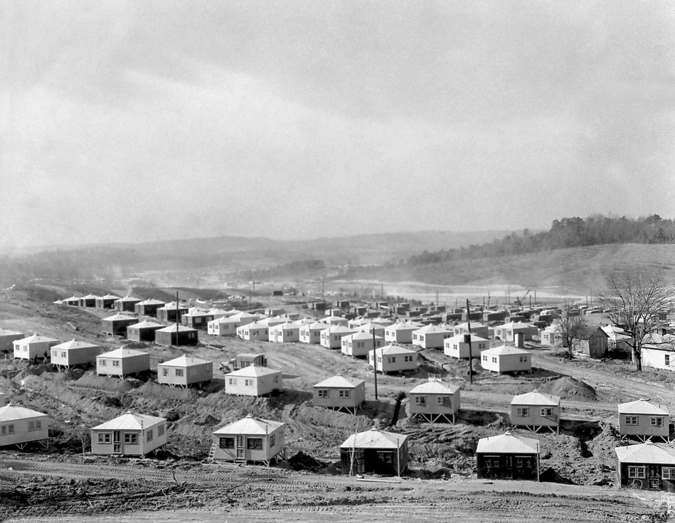
Lake Sakakawea, one of the largest man-made lakes in the US, sits in western North Dakota and was formed by the creation of Garrison Dam on the Missouri River. Its formation inundated more than 150,000 acres and displaced entire communities, including the towns of Sanish and Van Hook.
The flooding especially devastated the Fort Berthold Indian Reservation, home to the Mandan, Hidatsa, and Arikara Nation. Residents were forced to relocate to higher ground, often with minimal compensation and insufficient housing.
The towns of old Sanish and Van Hook were left behind. New towns bearing the same names were built nearby, but the original sites remain submerged. For the Three Affiliated Tribes, the lake represents not just lost towns, but cultural trauma and a broken treaty legacy.
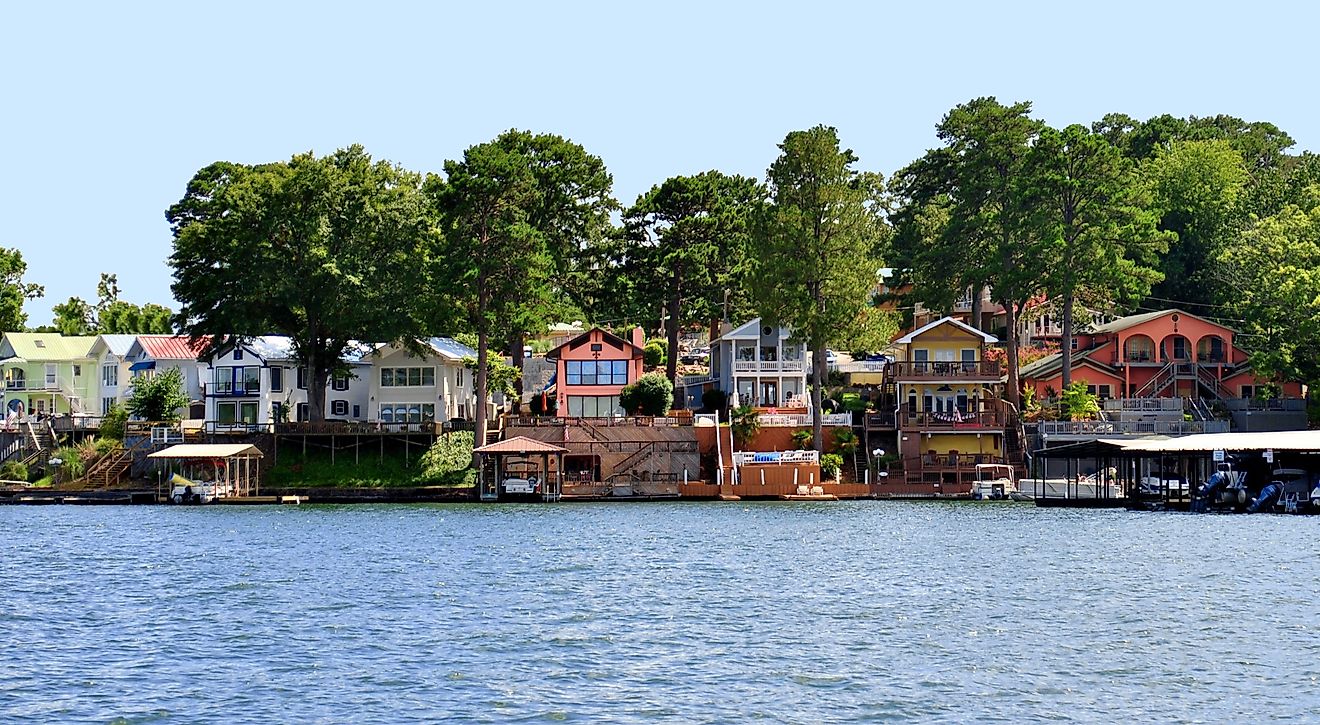
Lake Cumberland, Kentucky

Sunken Town: Rowena
Created: 1952
Cause: Construction of Wolf Creek Dam
Rowena, Kentucky, was a small riverside town located in Russell County. When the U.S. Army Corps of Engineers built the Wolf Creek Dam to manage flooding and generate hydroelectric power, the Cumberland River rose and swallowed Rowena.
Lake Cumberland is now a major recreation destination in Kentucky, attracting boaters and anglers year-round. Yet beneath its deep waters, the remains of Rowena still exist. During times of low water levels, some structures and bridge pilings have become visible.
While Rowena was not a large town, it was a tight-knit community. Graves were relocated, homes were moved where possible, and residents dispersed. What couldn't be saved was left behind beneath the surface.
Quabbin Reservoir, Massachusetts

Sunken Towns: Dana, Prescott, Enfield, Greenwich
Created: 1939
Cause: Creation of a drinking water reservoir for Boston
The Quabbin Reservoir in central Massachusetts is one of the most well-known examples of entire towns being erased for a greater municipal purpose. In the 1930s, the state flooded the Swift River Valley to create a new reservoir for the growing city of Boston. The result was the drowning of four towns: Dana, Prescott, Enfield, and Greenwich.
More than 2,500 residents were relocated. Homes, schools, post offices, and even cemeteries were dismantled or buried. The reservoir was completed in 1939, and the towns disappeared from maps.
Though many structures were removed before flooding, foundations and roads still lie below the surface. Some streets and cellar holes can still be explored in the areas surrounding the reservoir, now protected as conservation land.
Lake Oroville, California

Sunken Town: Bidwell’s Bar
Created: 1968
Cause: Construction of Oroville Dam
Bidwell’s Bar was a gold rush town founded in the 1850s along the Feather River in northern California. It was once a bustling outpost with hotels, saloons, and one of the first wire suspension bridges in the West.
The construction of Oroville Dam in the 1960s led to the creation of Lake Oroville, which submerged the original site of Bidwell’s Bar. A few buildings were relocated, and the historic bridge was moved to higher ground, where it can still be seen today.
When drought reduces water levels in Lake Oroville, remnants of the original town sometimes reappear, including old building foundations and mining equipment. Though Bidwell’s Bar is gone, its history is preserved in museum exhibits and interpretive signs around the lake.
Hidden Histories Beneath the Surface

The lakes on this list are more than just bodies of water. Each one holds the memory of a community that once stood proudly above ground. Whether the result of 20th-century engineering projects or wartime needs, the flooding of these towns speaks to how landscapes and lives have been altered in the name of progress.
In some places, ruins are visible when water levels drop. In others, they remain buried in silence, known only through stories, artifacts, and faint traces on satellite maps.
These sunken towns challenge us to remember what was lost beneath the surface. They remind us that every lake has a history—and sometimes, that history includes entire lives, communities, and cultures that vanished to make way for something else.
7 US Lakes With Sunken Towns
| Lake | State(s) | Town(s) Submerged | Year Created | Reason for Flooding |
|---|---|---|---|---|
| Lake Lanier | Georgia | Oscarville | 1956 | Buford Dam for water and flood control |
| Lake Mead | Nevada, Arizona | St. Thomas | 1935 | Hoover Dam and reservoir creation |
| Fontana Lake | North Carolina | Proctor | 1944 | Fontana Dam for WWII hydroelectricity |
| Lake Sakakawea | North Dakota | Sanish, Van Hook | 1953 | Garrison Dam and flood control |
| Lake Cumberland | Kentucky | Rowena | 1952 | Wolf Creek Dam for hydroelectric power |
| Quabbin Reservoir | Massachusetts | Dana, Prescott, Enfield, Greenwich | 1939 | Public drinking water supply for Boston |
| Lake Oroville | California | Bidwell’s Bar | 1968 | Oroville Dam and reservoir development |
Frequently Asked Questions
Are any of these sunken towns accessible today?
Yes. During droughts or low water years, ruins in places like St. Thomas (Lake Mead) and Bidwell’s Bar (Lake Oroville) have reemerged. In other cases, hiking trails and memorials lead to what remains above water.
Were residents compensated before their towns were flooded?
Compensation varied widely. Some residents were fairly paid and relocated, while others (particularly Native American and Black communities) received little support or acknowledgment.
Are any artifacts or structures preserved underwater?
Yes. In many cases, roads, foundations, and metal structures remain intact beneath the lakes. Divers and researchers sometimes explore these sites when conditions allow.
Do these lakes still serve their original purpose?
Most still provide water, hydroelectricity, or flood control, and some are now popular recreation destinations.