The Oldest Planned Cities in the United States
Long before skyscrapers pierced the sky and suburban sprawl took over the map, a handful of cities in the United States were meticulously laid out with vision, order, and ambition. These weren’t settlements that simply grew around rivers or ports—they were planned, with street grids, civic centers, and grand designs meant to guide the future of a young nation. Today, these cities offer a window into the early American mindset—equal parts idealism, practicality, and bold urban experimentation.
From colonial blueprints to Enlightenment-era philosophies, the oldest planned cities in the US reveal more than just clever design—they tell stories of power, politics, and the pursuit of a better way to live. Let’s explore the origins, architecture, and historical quirks of America’s first master-planned municipalities.
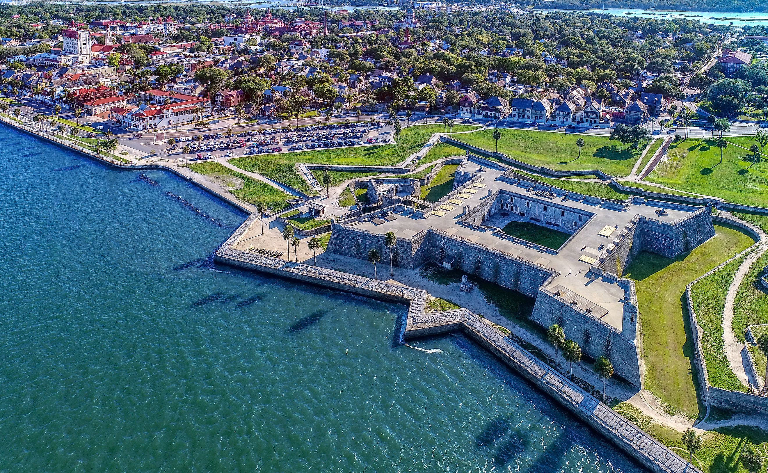
St. Augustine, Florida (1565)

Planned by: Spanish settlers under Pedro Menéndez de Avilés
Claim to fame: Oldest continuously inhabited European-established settlement in the continental US
Although the Spanish founded several outposts in the New World, St. Augustine was the first to stick—and it was no haphazard camp. The city's early layout followed the Laws of the Indies, a comprehensive urban planning guide issued by the Spanish Crown that dictated how new towns in the Americas should be built. The design called for a central plaza (plaza mayor), a grid of streets, and proximity to a port.
Today, St. Augustine’s old town still reflects this early Spanish grid, anchored by Plaza de la Constitución, flanked by the Cathedral Basilica, and shadowed by Castillo de San Marcos, a coquina stone fortress that’s been standing since the 1600s. Meandering its cobbled streets is like walking through a 16th-century European village—only with palm trees and ghosts.
Santa Fe, New Mexico (1610)

Planned by: Spanish colonists
Claim to fame: Oldest capital city in the US
Santa Fe isn’t just old—it’s the oldest state capital in the United States. Established in 1610 by Spanish governor Don Pedro de Peralta, Santa Fe was one of the earliest examples of planned urban development on the continent, also guided by the Laws of the Indies.
At the heart of Santa Fe is its iconic central plaza, a signature feature of Spanish colonial planning. This plaza was surrounded by key institutions: religious, governmental, and commercial. The Palace of the Governors—still standing today—is one of the oldest public buildings in continuous use in the country. Nearby, the San Miguel Chapel, believed to be the oldest church structure in the US, further anchors the city’s spiritual and architectural history.
What sets Santa Fe apart from other early American cities is how it blended Old World planning principles with the realities of the New World. Spanish engineers and planners adapted their grid layout to the contours of the high desert and to the existing Pueblo communities that had already shaped the region. The result was a city that felt both intentional and organic—a rare hybrid of colonial authority and indigenous context.
Today, Santa Fe’s adobe architecture, narrow streets, and central plaza remain a living tribute to that original design. While the city has modernized, its bones still reflect the logic and legacy of its 17th-century planners.
Philadelphia, Pennsylvania (1682)

Planned by: William Penn
Claim to fame: One of the first cities in the world to be laid out with a grid and public parks
William Penn didn’t just want a city; he envisioned a “green country town” that would embody his Quaker values: peace, order, and equality. The result? Philadelphia, one of the most ambitious urban planning projects of its time.
Penn’s grid was revolutionary. Instead of narrow, winding medieval streets like those of London, Philadelphia was designed with wide avenues, public squares, and rectangular blocks. It was the first American city with zoning built into its DNA, and its five original squares (like Rittenhouse and Franklin) are still public parks today.
Philadelphia's grid inspired urban planners across America and even influenced the design of cities as far as Washington, D.C. and Savannah, Georgia.
Annapolis, Maryland (1695)

Planned by: Francis Nicholson
Claim to fame: A Baroque radial design still visible in its layout
Annapolis stands out for its European-inspired radial street plan—a departure from the typical grid. Lieutenant Governor Francis Nicholson designed the city to reflect Baroque ideals: two major circles (State Circle and Church Circle) linked by diagonal streets radiating like sunbeams.
This design wasn’t just aesthetic—it symbolized the authority of church and state, both placed prominently at the center of civic life. The Maryland State House—still the oldest US state capitol in continuous legislative use—anchors State Circle, while St. Anne’s Episcopal Church dominates Church Circle.
This carefully planned, symbolic layout remains largely intact, and it gives Annapolis an elegant, European character few American cities can claim.
Savannah, Georgia (1733)

Planned by: James Oglethorpe
Claim to fame: The best-preserved city plan in the US
Savannah might be the most famous example of American urban planning, thanks to its modular ward system designed by General James Oglethorpe. Each ward featured a central square surrounded by residential “tything” lots and civic “trust” lots.
This plan allowed for scalable growth, ensuring that new neighborhoods maintained a consistent aesthetic and function. By 1851, Savannah had 24 public squares—22 of which remain today—making the city a case study in livable urbanism.
Tree-lined streets, moss-draped oaks, and consistent green spaces make Savannah one of the most beautiful and walkable cities in America. Its design has influenced everything from modern New Urbanism to film settings.
New Haven, Connecticut (1638)

Planned by: Puritan settlers led by John Davenport and Theophilus Eaton
Claim to fame: America’s first planned city based on a grid
Before William Penn drew his grid in Philadelphia, New Haven’s Puritans beat him to the punch. The city was laid out in a 9-square grid centered on the New Haven Green, which remains a public space today.
This plan was inspired by Biblical and classical models and emphasized order, equality, and communal values. Its design was not only practical but also spiritual—each square had a function, with the Green serving as a civic, religious, and burial space.
New Haven’s plan was one of the earliest examples of religious idealism influencing urban form, and it shaped early thinking about civic organization in the colonies.
Washington, D.C. (1791)

Planned by: Pierre Charles L’Enfant
Claim to fame: First purpose-built national capital in the modern world.
When the US needed a new capital, George Washington tapped French-American architect Pierre L’Enfant to design a city worthy of a new republic. The result was Washington, D.C., a city of grand boulevards, radial avenues, sightlines, and monumental architecture.
Inspired by Baroque planning and Enlightenment ideals, L’Enfant’s plan intentionally mixed a grid with diagonals, allowing for broad vistas, military defense, and symbolically powerful intersections (such as where the White House and Capitol connect).
Though the original plan was briefly abandoned, it was revived in the early 20th century. Today, D.C. is still a showcase of monumental planning—with National Mall, traffic circles, and wide avenues acting as key components of its early design.
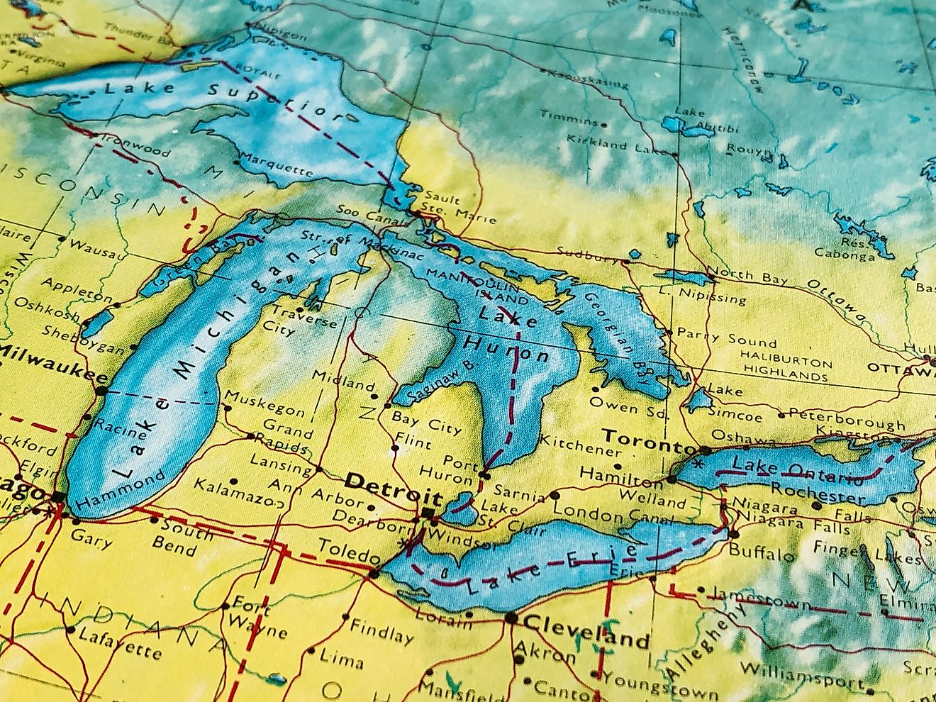
Detroit, Michigan (1805 Plan)

Planned by: Augustus Woodward
Claim to fame: “The Paris of the West”—a radial city built from the ashes.
After a catastrophic fire in 1805, Detroit had a rare opportunity: to rebuild from scratch. Judge Augustus Woodward seized it with ambition, sketching a radial street system inspired by Paris and Washington, D.C.
His plan called for broad avenues, circular plazas, and triangular blocks. Though never fully implemented, enough of Woodward’s vision survives in central Detroit to give the city its unusual layout, including Grand Circus Park and the streets named after states.
While later growth followed more conventional grids, Woodward’s radial core gave Detroit a unique urban signature, especially for a Midwestern industrial city.
Timeless Designs That Shaped a Nation

The United States may be a relatively young country, but it’s rich with urban visionaries who imagined cities not just as places to live, but as reflections of ideals. Whether influenced by European monarchies, religious doctrine, Enlightenment philosophy, or practical defense strategies, these cities tell the story of America’s roots—not just in history, but in design.
So next time you're wandering the orderly grid of Philadelphia, the sunny plazas of Santa Fe, or the mossy squares of Savannah, know this: you’re not just sightseeing—you’re walking through the dreams of early American planners who shaped the nation one city block at a time.
A Quick Look at America's Oldest Planned Cities
| City | Founded | Planner | Notable Feature |
|---|---|---|---|
| St. Augustine, FL | 1565 | Pedro Menéndez de Avilés | Spanish colonial grid |
| Santa Fe, NM | 1610 | Spanish colonists | Pueblo-Spanish fusion |
| New Haven, CT | 1638 | Puritan settlers | 9-square grid |
| Philadelphia, PA | 1682 | William Penn | Grid with public squares |
| Annapolis, MD | 1695 | Francis Nicholson | Radial Baroque design |
| Savannah, GA | 1733 | James Oglethorpe | Modular ward system |
| Washington, D.C. | 1791 | Pierre L’Enfant | Grid + radial avenues |
| Detroit, MI | 1805 (redesign) | Augustus Woodward | Paris-style radial plan |
Common Questions About America's Planned Cities
What’s the difference between a “planned” and “unplanned” city?
A planned city is intentionally designed before significant settlement occurs, often using a grid, radial, or modular system. Unplanned cities typically evolve over time without a central design, often following trade routes, topography, or historical accidents.
Are there newer planned cities in the US?
Yes! Cities like Columbia, Maryland, Reston, Virginia, and Celebration, Florida are 20th-century examples of master-planned communities. But they owe a debt to early cities like Philadelphia and Savannah.
Why didn’t more cities follow the radial design like Washington, D.C.?
Radial plans are elegant but hard to scale and confusing for navigation. The grid system—used in places like New York and Chicago—proved more efficient for expansion and land division.
Can you still see these original plans today?
Absolutely. Many of the streets, public squares, and even building orientations in cities like Savannah and Annapolis still follow their 18th-century plans.