Capitol Reef
Located in south-central Utah’s canyon country, Capitol Reef National Park is one of the most underrated gems in the American Southwest. While Zion, Bryce Canyon, and Arches often steal the spotlight, Capitol Reef quietly draws in travelers seeking solitude, scenery, and a striking geologic story written across 70 miles of sandstone cliffs, canyons, domes, and desert.
Spanning 378 square miles, Capitol Reef is a remote but richly diverse national park where history, geology, and ecology intersect beneath the towering rock formations of the Waterpocket Fold. Designated a national monument in 1937 and elevated to national park status in 1971, it remains less trafficked than Utah’s other “Mighty Five” parks—yet its scenery and scientific significance are no less impressive.
What Is Capitol Reef, Exactly?

The park's unusual name reflects its defining features. Early explorers and settlers referred to impassable sandstone ridges as “reefs,” likening them to maritime obstacles. The “Capitol” portion comes from the white Navajo sandstone domes that resemble the US Capitol building. Together, “Capitol Reef” describes a geologic barrier that once made this area notoriously difficult to traverse.
The park’s spine is the Waterpocket Fold, a 100-mile-long wrinkle in the Earth’s crust known as a monocline. This immense uplift was created roughly 70 million years ago during the Laramide orogeny—a mountain-building event that helped form the modern Rocky Mountains. Over millions of years, erosion sculpted the fold’s exposed layers into cliffs, canyons, domes, and spires, revealing a cross-section of Earth’s geologic history dating back more than 200 million years.
A Landscape of Sculpted Stone

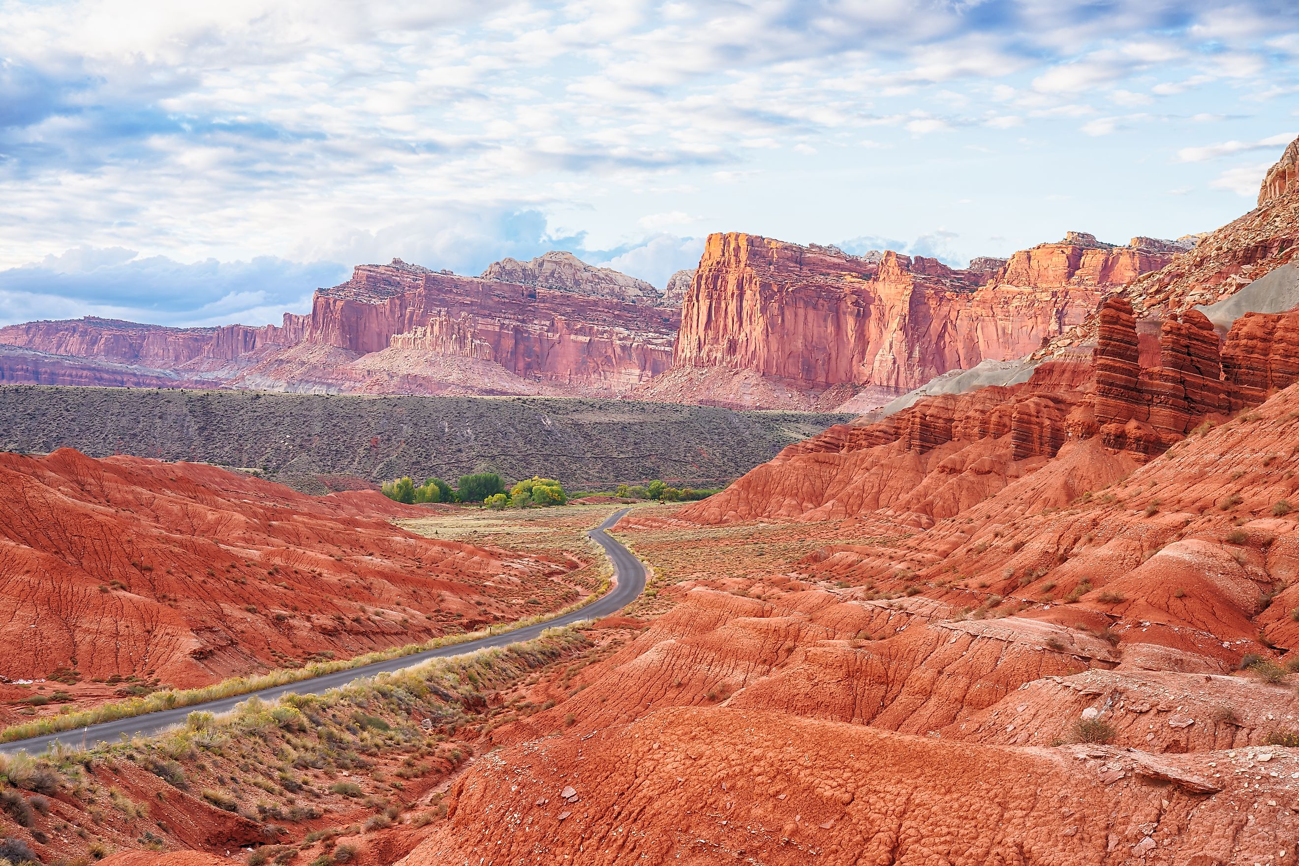
Geologically, Capitol Reef is a textbook of sedimentary rock. The towering Wingate Sandstone cliffs, colored in hues of deep red and orange, dominate the landscape. Atop them, white and yellow layers of Navajo Sandstone form the iconic domes that give Capitol Reef its name.
Among the park’s best-known formations is Hickman Bridge, a massive natural arch located near the park's visitor center in the Fruita area. Nearby, The Castle, a fortress-like formation rising above Sulphur Creek, is one of Capitol Reef’s most recognizable sights.
Further north, Cathedral Valley offers an otherworldly landscape punctuated by monolithic sandstone towers carved from the Entrada Formation. These freestanding "cathedrals" of red rock seem to rise from nowhere, isolated on the valley floor.
In the south, remote Halls Creek Narrows carves a serpentine path through colorful canyons, offering backcountry adventurers a challenging yet scenic hiking destination.
A Living, Breathing Desert Ecosystem

Despite its dry, high-desert climate, Capitol Reef supports a wide array of plant and animal life. The park receives only about 7 inches of rain per year, mostly during late summer monsoons that can trigger sudden and dangerous flash floods in the canyons.
The valley floors are dominated by sagebrush and native grasses, while piñon pines and junipers cling to rocky slopes. At higher elevations, visitors can find conifer forests, including rare bristlecone pines. Streams and riparian areas support cottonwoods, willows, and wildflowers in spring—though invasive species like tamarisks and Russian olives have encroached in some areas.
Wildlife watchers might spot desert bighorn sheep, mule deer, coyotes, and yellow-bellied marmots. Birdlife is abundant year-round, from jays and magpies to golden eagles and bald eagles in winter. Reptiles and amphibians thrive near the streams, and the Utah chub swims in the park’s waterways alongside trout and suckers.
Fruita: A Lush Oasis with a Pioneer Past

At the heart of Capitol Reef lies Fruita, a surprisingly verdant area where the Fremont River supports orchards, grassy meadows, and cottonwood groves. Originally settled in the 1880s by Mormon pioneers, Fruita was once a small agricultural community known as Junction.
The early settlers planted apple, pear, peach, apricot, and cherry orchards, many of which still bear fruit today. The Gifford Homestead, Fruita Schoolhouse, and historic barn remain preserved near the visitor center as reminders of the park’s human history.
Even more ancient are the petroglyphs etched into nearby cliff walls by the Fremont people, a pre-Columbian culture that inhabited this area from around 800 to 1300 AD. These rock carvings depict human and animal figures, geometric designs, and possible spiritual symbols—silent messages from an ancient civilization whose fate remains a mystery.
How to Explore Capitol Reef

While much of the park remains rugged and remote, Capitol Reef is surprisingly accessible. Utah State Route 24 cuts across the northern part of the park, following the Fremont River and passing close to Fruita.
From here, the Scenic Drive winds southward for 8 miles, offering access to Capitol Gorge and Grand Wash. Short hikes from roadside pullouts lead to spectacular views, slot canyons, and even ancient inscriptions from early Mormon settlers carved into the canyon walls.
For those with high-clearance or 4WD vehicles, backcountry roads lead to Cathedral Valley, Burr Trail, and the southern reaches of the Waterpocket Fold. These areas reward intrepid visitors with solitude and staggering views of Utah’s most dramatic desert formations.
The park is also home to numerous hiking trails, ranging from easy loops to strenuous climbs. Popular routes include:
-
Hickman Bridge Trail – A 1.8-mile round-trip hike to a stunning natural arch.
-
Grand Wash Trail – A 4.4-mile route through a deep canyon with towering walls.
-
Cohab Canyon Trail – A moderately challenging route with views of Fruita.
-
Cassidy Arch Trail – A 3.4-mile hike that leads to a photogenic arch named after the outlaw Butch Cassidy.
Backpacking routes like Lower Muley Twist Canyon or Halls Creek Narrows offer extended wilderness experiences for experienced hikers.
Practical Tips for Visitors

-
When to Go: Spring (April–June) and fall (September–October) are ideal, with pleasant temperatures and blooming wildflowers or fall foliage. Summers can be hot (90°F+), while winters are cold and occasionally snowy.
-
What to Bring: Water, sun protection, and appropriate footwear are essential. Cell service is limited, so download maps and info in advance.
-
Where to Stay: There’s a developed campground in Fruita (reservations recommended in peak season), but no lodges or restaurants inside the park. Torrey, Utah (11 miles west), offers lodging, food, and fuel.
-
Safety Note: Flash floods are a real hazard in narrow canyons. Always check weather forecasts before venturing into wash areas.
FAQs About Capitol Reef National Park
What is Capitol Reef known for?
Capitol Reef is known for the Waterpocket Fold, a massive geologic wrinkle, as well as its domes, canyons, and sandstone formations. It's also home to the historic Fruita orchards.
Is Capitol Reef worth visiting?
Absolutely. It offers stunning scenery with fewer crowds than other Utah parks, making it ideal for hiking, photography, and solitude.
How long should I spend in the park?
One to two days is enough to explore Fruita and hike a few trails. Three or more days allow for scenic drives and backcountry adventures.
Is Capitol Reef family-friendly?
Yes. The park offers easy hikes, educational exhibits, and picnic spots. The Fruita area is especially accessible for kids.
Are there fees to enter?
Yes. As of 2025, the entrance fee is $20 per vehicle for a 7-day pass. Annual and interagency passes are also available.