America’s Largest Drained Lake
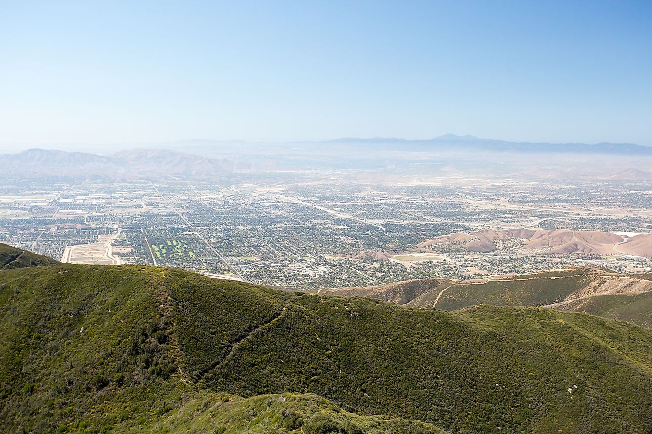
In California’s southern San Joaquin Valley, a vast expanse of farmland stretches across what was once the largest freshwater lake west of the Mississippi River. This is the former bed of Tulare Lake, a massive body of water that once covered up to 790 square miles during seasonal floods.Tulare Lake was not only immense in size but vital to Indigenous communities, wildlife, and the regional hydrology.
Yet by the early 20th century, this enormous lake had vanished. Tulare Lake was not drained by drought or natural disaster, but by human intervention. In a span of decades, agricultural development, dam building, and water diversions transformed it from a thriving aquatic ecosystem into an engineered landscape of irrigation canals, cotton fields, and livestock feedlots.
The story of Tulare Lake is one of both environmental transformation and consequence. It's a case study in how humans can reshape geography, alter ecosystems, and set into motion long-term changes still felt today.
A Shifting Inland Sea

Tulare Lake once sat at the lowest point of the Tulare Basin, a closed hydrological system with no natural outlet to the ocean. Water from the Kings, Kaweah, Tule, and Kern rivers flowed into the basin from the nearby Sierra Nevada Mountains. During years of heavy snowmelt or rainfall, the lake would swell dramatically, expanding far beyond its usual bounds and submerging vast portions of what is now Kings and Tulare Counties.
At full capacity, Tulare Lake rivaled the size of modern-day Lake Tahoe. The lake's depth varied depending on the season, but it averaged around 30 feet deep during its largest seasonal expansions. It also supported a diverse wetland environment that included tule marshes, cottonwoods, willows, and extensive fisheries.
Because Tulare Lake was endorheic (meaning it had no outflow to the ocean) it was sensitive to any change in water volume. During particularly wet years, overflow could sometimes reach the San Joaquin River through a natural spillway known as Fresno Slough. But in most years, water simply evaporated or seeped into the ground, leaving behind mineral-rich soil and sustaining the lake’s wetlands.
Lifeline for Indigenous Communities

Painting by C. E. Grunsky of Tulare Lake. Editorial credit: C. E. Grunsky, Public domain, via Wikimedia Commons
Before European settlement, Tulare Lake was home to several Native American communities, including the Yokuts. For generations, the lake provided food, transportation, and cultural connection. The Yokuts harvested tule reeds to build boats and shelters, fished for native species such as Sacramento perch, and hunted waterfowl in the surrounding marshes.
The lake and its seasonal rhythms shaped Yokuts life. Its presence was not simply a geographic feature but a centerpiece of survival and spirituality. Oral histories, hunting practices, and seasonal migrations were all linked to the rise and fall of Tulare’s waters.
This way of life began to unravel as European-American settlers moved into the valley in the 19th century. Land was claimed, water was redirected, and wetlands were drained to make way for agriculture. As Tulare Lake receded, so did the traditional livelihoods and cultural patterns of the Indigenous people who depended on it.
Engineering the Disappearance

The transformation of Tulare Lake from a vast inland sea to a dry lakebed happened rapidly in historical terms. Beginning in the late 1800s and accelerating through the early 20th century, settlers and developers built dams, canals, and levees to control the rivers feeding the lake. Their goal was to divert water toward irrigation, fueling the growth of Central Valley agriculture.
Massive reclamation projects were launched. Rivers were channelized and re-routed into irrigation ditches. By 1900, most of the inflow to Tulare Lake had been cut off or redirected. By the 1920s, large-scale farming dominated the region, and the lake had largely disappeared in dry years. In wet years, it still occasionally reappeared, much to the frustration of farmers who viewed it as an obstacle to productivity.
Throughout the 20th century, agricultural interests lobbied for stronger flood control measures. Reservoirs like Pine Flat Dam (on the Kings River) and Terminus Dam (on the Kaweah River) were constructed to regulate water flow and prevent flooding into the Tulare Basin. These structures effectively eliminated the lake’s seasonal reappearance in all but the wettest years.
A Flood That Brought the Lake Back

Despite nearly a century of drainage and diversion, Tulare Lake is not entirely gone. It still exists as a phantom lake, one that returns under rare and extreme conditions. That’s exactly what happened in 2023, when a series of atmospheric river storms and historic Sierra Nevada snowmelt caused the lake to rise from its grave.
Fields and towns built atop the dry lakebed were inundated. Roads became impassable. Livestock operations were flooded. The sudden reappearance of Tulare Lake served as a dramatic reminder that even the most engineered landscapes are still subject to nature’s forces.
The event sparked debates over water management, climate change, and the risks of building over former wetlands. While some saw the flood as a natural reset, others viewed it as a disaster exacerbated by short-sighted development and land use planning.
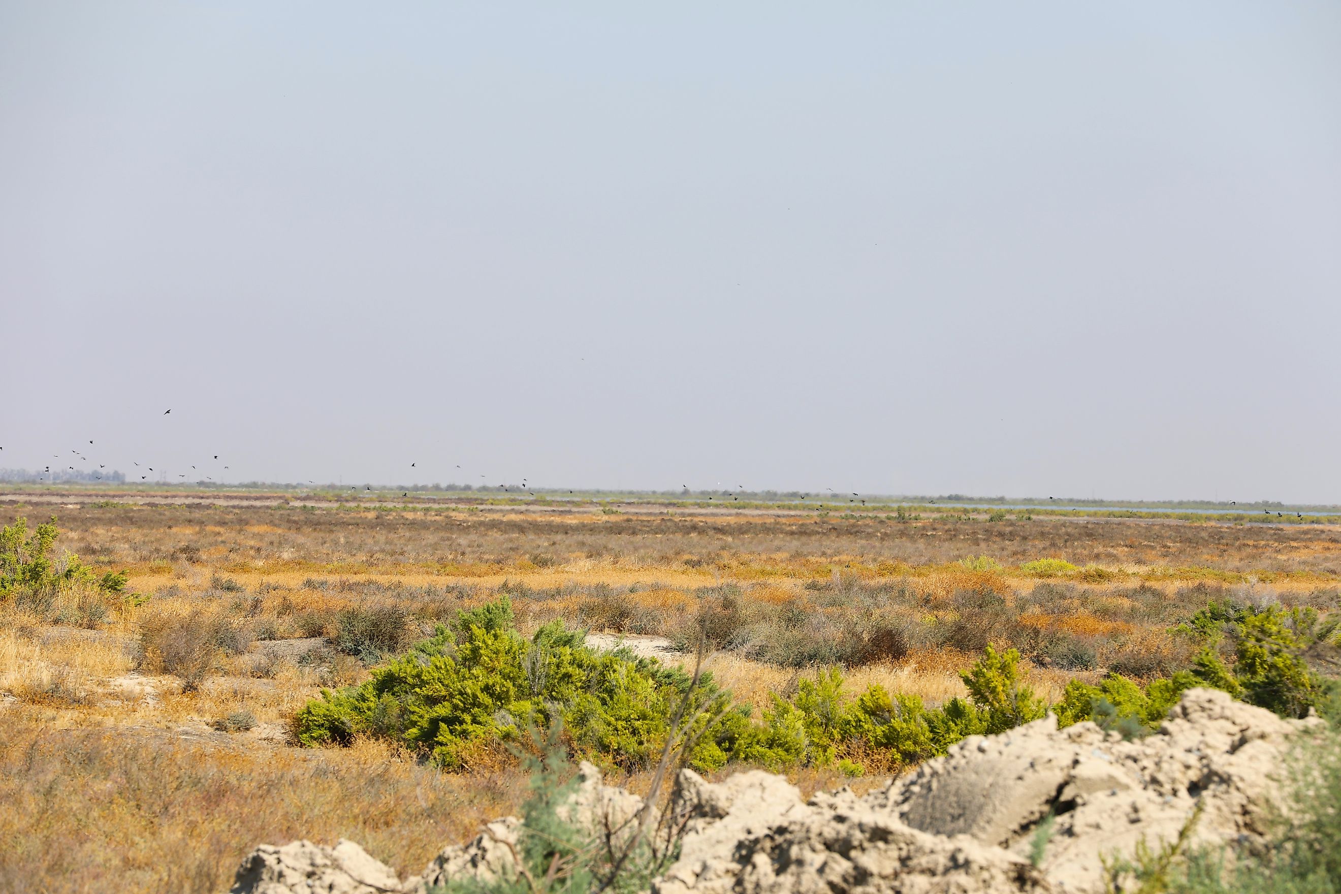
Agriculture on a Lakebed

What once was a thriving aquatic habitat is now some of the most intensely farmed land in the United States. Crops like cotton, alfalfa, tomatoes, and pistachios dominate the landscape that was once submerged under Tulare Lake. The J.G. Boswell Company, one of the largest farming operations in the country, owns tens of thousands of acres on the former lakebed.
Agricultural productivity in this region depends on both surface water from the Sierra Nevada and extensive groundwater pumping. During drought years, when surface water is scarce, farms turn to wells that extract water from deep underground aquifers. This practice has led to land subsidence—a gradual sinking of the ground that can damage infrastructure and further complicate water delivery.
Because the soils beneath the former lake are rich with nutrients, the region is fertile. But it is also fragile. Overdrafting of groundwater, salt buildup from irrigation, and the loss of natural flood control mechanisms pose long-term risks to both farming and the environment.
Environmental Consequences

Draining Tulare Lake not only transformed the landscape but also caused significant ecological loss. Vast wetland habitats vanished, migratory bird populations plummeted, and native fish species disappeared. The interconnectedness of the Central Valley’s hydrology was broken, and with it, the region’s ability to naturally buffer droughts and floods.
The loss of wetlands also impacted air quality. In the dry season, wind can stir up dust from the exposed lakebed, contributing to respiratory problems in nearby communities. The San Joaquin Valley already ranks among the most polluted air basins in the country, and the former lakebed is part of that problem.
Some efforts have been made to restore small wetland areas in the Central Valley, but they represent only a fraction of what once existed. Conservationists argue that protecting and rehabilitating remnant wetlands is essential for wildlife, groundwater recharge, and climate resilience.
A Future With or Without the Lake

Tulare Lake may be drained, but its legacy endures. It remains a cautionary tale about the consequences of large-scale environmental engineering and a reminder that water will always follow its own path, no matter how many barriers are placed in its way.
Climate change is altering precipitation patterns, snowmelt timing, and storm intensity. As California contends with more extreme weather, there are renewed calls to rethink water management strategies in the Central Valley. Some propose restoring natural floodplains in the Tulare Basin, allowing certain areas to absorb water during high flows and reducing pressure on levees and reservoirs.
Others call for stricter controls on groundwater use, or investment in infrastructure that reflects the real hydrological limits of the land. Either way, Tulare Lake is a powerful symbol of how the past and future collide in California’s most critical agricultural region.
A Vanished Lake With a Persistent Shadow
Tulare Lake no longer appears on modern maps, but its presence is felt in every dust storm, flooded field, and irrigation canal that now defines California’s Central Valley. Once teeming with fish, birds, and Indigenous life, it was sacrificed in the name of agriculture and growth.
The lake may be gone, but it isn’t forgotten. And as recent floods have shown, nature still remembers where Tulare Lake once stood.
