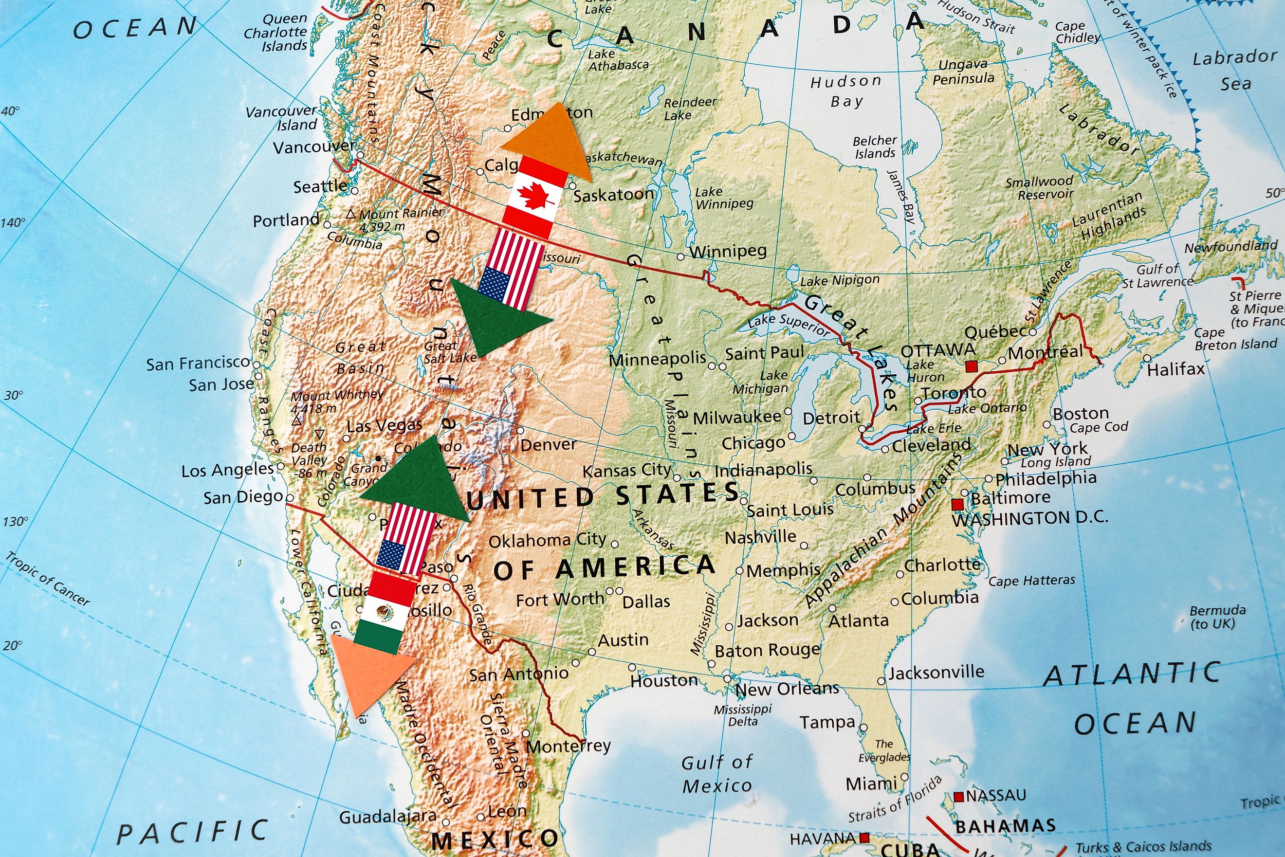
Which US States Border Canada?
The United States and Canada share the longest undefended land border in the world, stretching over 5,500 miles from the Atlantic Ocean to the Pacific and into the Arctic. This vast boundary, defined by mountains, rivers, forests, lakes, and sometimes just a remote marker in the wilderness, plays a key role in the political, economic, and cultural exchange between the two nations.
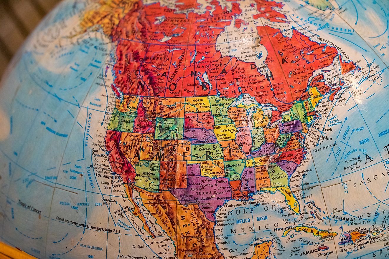
But which US states actually border Canada? The answer: 13 states, spanning across the northernmost parts of the continental US and the entirety of Alaska. Some borders are major points of trade and travel, while others are rugged, sparsely populated areas where nature dominates. Takes a closer look at each of the US states and how they connect to Canada.
Alaska

Border Length with Canada: 1,538 miles
Canadian Provinces: British Columbia and Yukon
Alaska shares the longest US border with Canada, accounting for nearly 40% of the total US-Canada land boundary. The border runs through remote mountain ranges, dense forests, and icy terrain, making it one of the most rugged and isolated international borders in North America.
While the terrain may be harsh, the border is strategically important. The Alaska Highway, originally built during World War II, runs from Dawson Creek, British Columbia, through Yukon and into Alaska, serving as a critical supply route. Border crossings at Tok and Skagway are among the most commonly used.
Washington
Border Length: 427 miles
Canadian Province: British Columbia
Washington is home to one of the busiest US-Canada border crossings: Blaine, where Interstate 5 becomes British Columbia Highway 99. The Peace Arch Border Crossing near Blaine symbolizes the long-standing peaceful relationship between the two countries.
Washington’s proximity to Vancouver makes it a popular travel route for both tourists and commercial traffic. The border also slices through the Salish Sea, making some of the maritime borders complex and heavily monitored.
Idaho
Border Length: 45 miles
Canadian Province: British Columbia
Though its border is short, Idaho’s connection to Canada is scenic. The boundary winds through mountainous regions and forested wilderness near Eastport, the site of a small but active border crossing.
Much of this area lies in the Selkirk Mountains, known for outdoor recreation. While not a commercial hotspot, it is frequented by backcountry adventurers and travelers headed to or from Creston, British Columbia.
Montana

Border Length: 545 miles
Canadian Provinces: British Columbia, Alberta, Saskatchewan
Montana shares its northern border with three Canadian provinces, making it one of the most connected US states in terms of international boundaries. The landscape transitions from Rocky Mountains in the west to vast plains in the east.
The Sweet Grass–Coutts crossing is the primary commercial port, linking Interstate 15 with Alberta’s Highway 4. Glacier National Park in Montana meets Canada’s Waterton Lakes National Park, forming the Waterton-Glacier International Peace Park, a UNESCO World Heritage Site.
North Dakota
Border Length: 310 miles
Canadian Province: Manitoba and Saskatchewan
North Dakota’s border with Canada cuts across open prairies, lakes, and rural towns. The Pembina-Emerson Port of Entry is the largest crossing in North Dakota and one of the most significant along the northern US frontier.
This area is central to grain and energy transport, with multiple rail lines and pipelines crossing the border. Nearby communities often maintain close ties across the international line.
Minnesota
Border Length: 547 miles
Canadian Province: Manitoba and Ontario
Minnesota’s border with Canada is rich in water features. The international boundary follows rivers and lakes, including Lake of the Woods and the Rainy River, and it features the unique Northwest Angle, the only part of the contiguous US that lies north of the 49th parallel.
This small sliver of land is accessible by boat or through Canada, making it a geographic oddity. Voyageurs National Park, a water-based national park, straddles the border and offers a natural connection between the two countries.
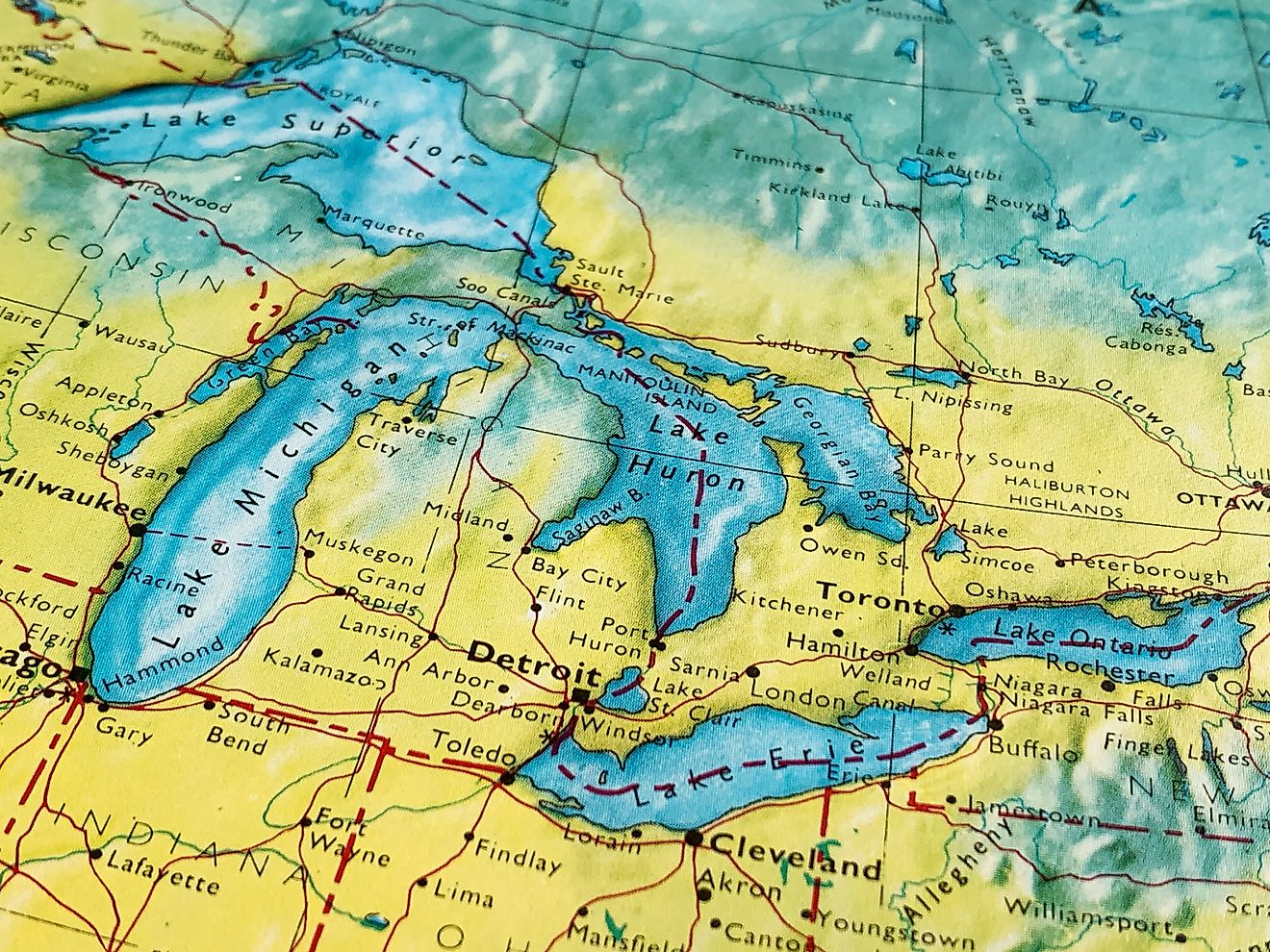
Michigan

Border Length: 721 miles (entirely water)
Canadian Province: Ontario
Michigan’s boundary with Canada is defined by the Great Lakes—Lakes Superior, Huron, and Erie—making it the state with the longest freshwater international border in the US.
Despite having no land connection, Michigan is a major gateway to Canada via bridges and tunnels:
-
Detroit–Windsor Tunnel
-
Ambassador Bridge (one of North America’s busiest trade crossings)
-
Blue Water Bridge in Port Huron
-
Sault Ste. Marie International Bridge
This connection fuels robust trade and tourism, especially between Detroit and Windsor, two cities divided only by the Detroit River.
Ohio
Border Length: ~146 miles (water boundary)
Canadian Province: Ontario
Ohio’s northern shoreline borders Lake Erie, and while it doesn’t have a land border, it still shares an international boundary through the lake. The closest Canadian city is Pelee Island, which lies directly north of Sandusky and Port Clinton.
Cleveland and Toledo maintain ferry and shipping routes that link to Canadian ports, supporting trade across the Great Lakes.
Pennsylvania
Border Length: 42 miles (water boundary)
Canadian Province: Ontario
Pennsylvania has a short but strategic connection to Canada via Lake Erie. Its shoreline centers on Erie, Pennsylvania, which serves as a regional port for commercial shipping across the lake.
While there is no direct land crossing, Pennsylvania’s Great Lakes access keeps it within the US-Canada trade and travel corridor.
New York

Border Length: 445 miles
Canadian Provinces: Ontario and Quebec
New York’s border with Canada is historic, heavily traveled, and economically vital. It includes land boundaries, rivers, and lakes. Major border points include:
-
Niagara Falls, shared with Ontario
-
Thousand Islands region on the St. Lawrence River
-
Champlain–St. Bernard de Lacolle crossing into Quebec
The Peace Bridge in Buffalo and the Rainbow Bridge in Niagara Falls are heavily used by tourists. Upstate New York maintains a strong cultural and economic link to southern Ontario and Quebec.
Vermont
Border Length: 90 miles
Canadian Province: Quebec
Vermont’s border with Canada runs through pastoral farmland and mountain valleys. The largest crossing is at Highgate Springs–St. Armand, which connects Interstate 89 to Quebec’s Route 133, making it a key route for trade and travel between Burlington and Montreal.
The Green Mountains and the Eastern Townships of Quebec offer shared geography and frequent cross-border visits for skiing, hiking, and local markets.
New Hampshire
Border Length: 58 miles
Canadian Province: Quebec
New Hampshire’s small stretch of border with Quebec lies in a forested, mountainous area. The primary crossing in Pittsburg connects to Chartierville in Quebec, via Route 3.
This quiet region is popular with hunters, anglers, and snowmobilers, but sees limited commercial traffic.
Maine

Border Length: 611 miles
Canadian Provinces: Quebec and New Brunswick
Maine shares the longest land border with Canada of any state in the eastern US. The international boundary traces rivers, forests, and rural towns.
Major crossings include:
-
Houlton–Woodstock, connecting I-95 with New Brunswick
-
Calais–St. Stephen, a major port of entry on the coast
Many Maine residents have family or business connections across the border, especially in Aroostook County, where cross-border agriculture and forestry remain vital.
Final Thoughts: More Than Just a Line on the Map
The border between the United States and Canada is far more than a political boundary. It’s a corridor of commerce, culture, and connection. From Detroit’s international bridges to the forests of northern Maine, the shared border spans major cities and remote outposts.
Whether you're planning a cross-border road trip, studying international trade, or simply curious about geography, the US-Canada border reflects the dynamic and deeply intertwined relationship between two of the world’s closest neighbors.
Summary Chart: US States That Border Canada
| State | Border Length | Type of Border | Canadian Provinces |
|---|---|---|---|
| Alaska | 1,538 miles | Land | British Columbia, Yukon |
| Washington | 427 miles | Land/Maritime | British Columbia |
| Idaho | 45 miles | Land | British Columbia |
| Montana | 545 miles | Land | British Columbia, Alberta, Saskatchewan |
| North Dakota | 310 miles | Land | Manitoba, Saskatchewan |
| Minnesota | 547 miles | Land/Water | Manitoba, Ontario |
| Michigan | 721 miles | Water (Great Lakes) | Ontario |
| Ohio | ~146 miles | Water (Lake Erie) | Ontario |
| Pennsylvania | 42 miles | Water (Lake Erie) | Ontario |
| New York | 445 miles | Land/Water | Ontario, Quebec |
| Vermont | 90 miles | Land | Quebec |
| New Hampshire | 58 miles | Land | Quebec |
| Maine | 611 miles | Land | Quebec, New Brunswick |