The 5 Longest Rivers in The United States
Rivers are more than just flowing water—they are the veins of the land, shaping history, fueling economies, and carving breathtaking landscapes across the United States. From the untamed wilds of Alaska to the heartland of the Midwest, these waterways have long been essential for transportation, commerce, and recreation. Discover the country’s five longest rivers, uncovering the stories behind these natural giants and the role they continue to play in American life.
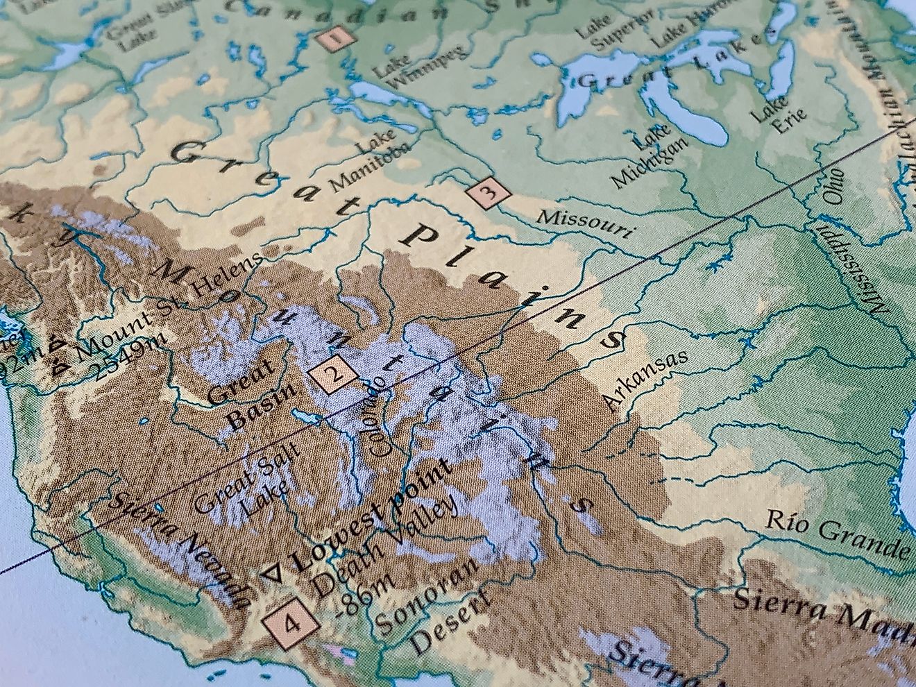
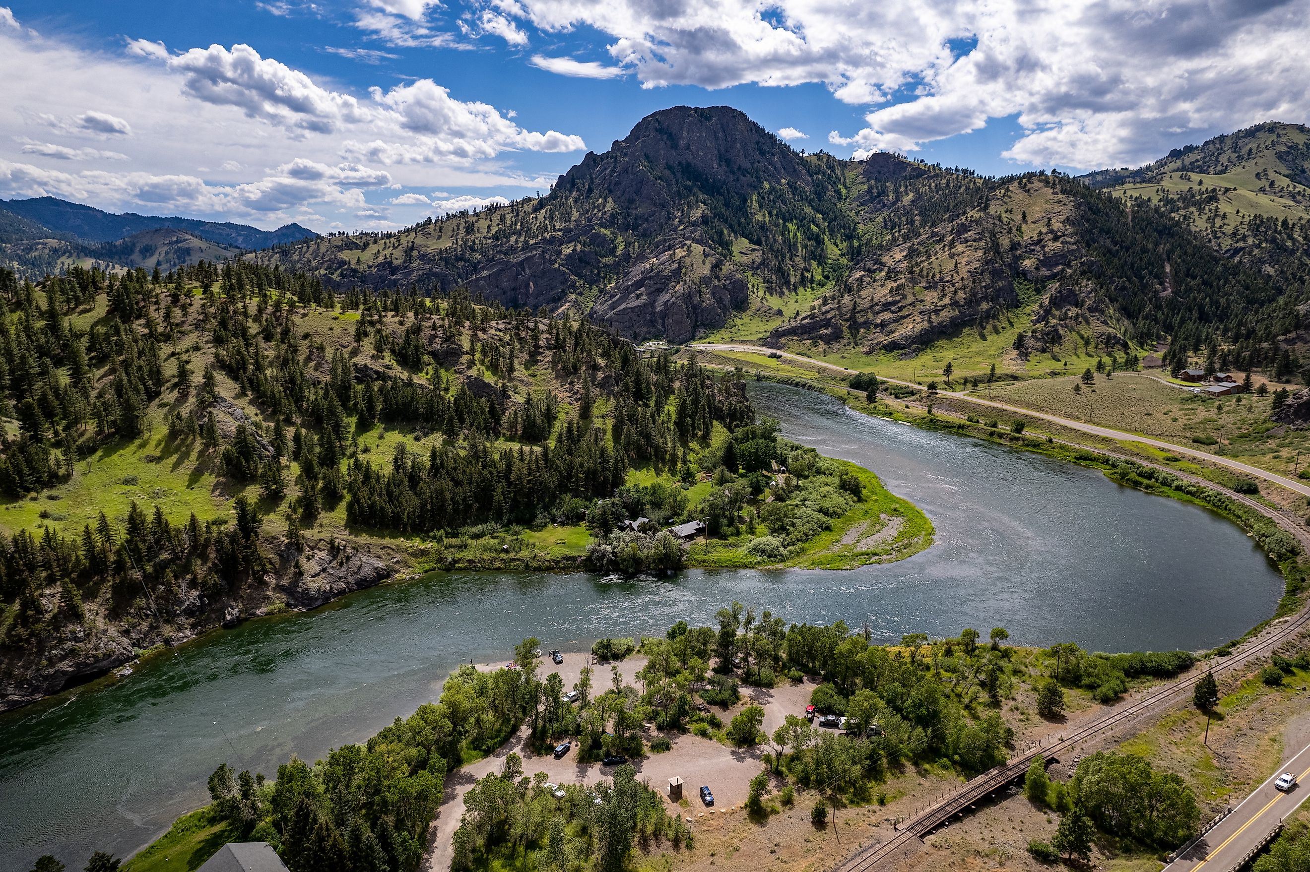
Missouri River— 2,341 miles

Spanning 2,341 miles, the Missouri River is the longest river in the United States, winding its way through seven states before joining the Mississippi River near St. Louis. It originates at the confluence of the Jefferson and Madison rivers in Montana, flowing north through North Dakota before curving southeast through South Dakota, Nebraska, Iowa, Kansas, and Missouri. Along its path, the river provides essential water for agriculture, supports diverse wildlife, and offers numerous recreational opportunities.
Historically, the Missouri River played a crucial role in the westward expansion. Lewis and Clark navigated its waters in the early 1800s, using it as a gateway to the uncharted West. Throughout the 19th century, steamboats transported goods and settlers along its course, fueling economic development.
Today, the river remains a vital resource, supplying drinking water to millions while supporting industries such as agriculture and energy production. However, the Missouri River also faces challenges, including pollution, habitat loss, and the impacts of climate change. Conservation efforts aim to preserve this essential waterway, ensuring it continues to serve as a lifeline for the Midwest.
Mississippi River—2,340 miles

At 2,340 miles long, the Mississippi River may be slightly shorter than the Missouri, but its impact on American life is unmatched. Beginning at Lake Itasca in Minnesota, the river flows southward, gathering waters from countless tributaries before reaching the Gulf of America. Its drainage basin is the fourth largest in the world, spanning 41% of the continental US and influencing the lives of millions.
Throughout history, the Mississippi has been a highway of commerce. In the 19th century, paddle-wheel steamboats carried cotton, lumber, and other goods along its waters, fueling the economy of riverfront cities such as St. Louis, Memphis, and New Orleans. Today, the river remains one of the busiest commercial waterways in the world, with barges transporting over 500 million tons of cargo annually.
In addition to its economic importance, the Mississippi is an ecological powerhouse, supporting a vast array of wildlife, including over 260 species of fish and migratory birds. However, pollution and habitat destruction threaten its delicate balance. Efforts to clean and restore the river are ongoing, ensuring its legacy endures for future generations.
Yukon River—1,980 miles

Flowing 1,980 miles through the remote wilderness of Canada and Alaska, the Yukon River is one of North America’s great untamed waterways. It begins in British Columbia, cutting through the Yukon Territory before entering Alaska, where it winds westward to empty into the Bering Sea. Unlike many other major rivers, much of the Yukon remains relatively untouched, making it a critical habitat for wildlife and an essential resource for Indigenous communities.
For centuries, the Yukon River has been a lifeline for the people of the North. Indigenous tribes used its waters for transportation, fishing, and trade long before European explorers arrived. During the Klondike Gold Rush of the late 1800s, prospectors relied on the river to access the goldfields of the Yukon, establishing settlements that still exist today.
In the modern era, the river continues to serve as an important transportation route for remote Alaskan communities, many of which are inaccessible by road. The Yukon is also a crucial ecosystem for salmon, supporting one of the longest fish migrations in the world. However, climate change, overfishing, and mining operations threaten its fragile environment. Conservation efforts aim to protect this wild and storied river.
Rio Grande River—1,900 miles

The Rio Grande stretches approximately 1,900 miles from the mountains of Colorado through New Mexico and Texas, forming a natural border between the United States and Mexico before reaching the Gulf of America. Its waters have sustained human life for thousands of years, from Indigenous civilizations to modern cities. Despite its importance, the Rio Grande faces increasing pressure from drought, overuse, and climate change.
For centuries, the river has played a crucial role in agriculture, providing irrigation for crops in arid landscapes. Today, farmers in both the US and Mexico depend on its waters, though demand often outpaces supply. In addition to its agricultural significance, the Rio Grande has cultural and historical importance. Ancient Puebloan societies built settlements along its banks, while Spanish explorers used it as a pathway for expansion.
The river’s rugged canyons, such as those in Big Bend National Park, also make it a hotspot for outdoor recreation, attracting kayakers, hikers, and wildlife enthusiasts. Despite its beauty and historical significance, the Rio Grande faces severe water shortages, with some sections drying up entirely in recent years. Efforts to manage and conserve its waters are critical to ensuring this iconic river remains a vibrant and essential part of the landscape.
Colorado River—1,450 miles

At 1,450 miles long, the Colorado River is one of the most important waterways in the western United States. It begins in the Rocky Mountains of Colorado, winding through Utah, Arizona, Nevada, California, and Mexico before emptying into the Gulf of California. Along its course, the river has shaped some of America’s most iconic landscapes, including the Grand Canyon, carved over millions of years by its relentless flow.
In addition to its geological significance, the Colorado River is a lifeline for over 40 million people. Its waters supply major cities such as Las Vegas, Phoenix, and Los Angeles, while also sustaining vast agricultural regions. However, the river is under immense strain. Decades of water diversions, combined with persistent drought and climate change, have dramatically reduced its flow.
The once-mighty river no longer reliably reaches the sea, a stark reminder of the challenges facing water management in the American West. Conservation efforts, including water-sharing agreements and habitat restoration projects, aim to preserve the Colorado for future generations. Despite these challenges, the river remains a symbol of both nature’s power and human ingenuity, shaping the land and lives of those who depend on it.
The Enduring Legacy of America’s Great Rivers
America’s longest rivers are more than just waterways—they are the lifeblood of the land, shaping history, culture, and industry while sustaining countless ecosystems. From the untamed wilderness of the Yukon to the bustling trade routes of the Mississippi, each river tells a unique story of resilience, exploration, and adaptation. They have served as highways for pioneers, sources of life for Indigenous communities, and foundations for modern cities.
Yet, these rivers also face mounting challenges, from climate change to overuse and pollution. As we look to the future, the preservation of these vital waterways is crucial, ensuring they continue to inspire, provide, and connect generations to come. Whether admired for their breathtaking landscapes or their deep historical significance, America’s rivers remain an enduring symbol of the nation's natural beauty and spirit of perseverance.