Which US States Border Mexico?
The southern border of the United States is more than just a political boundary. It is a region rich in culture, shaped by centuries of trade, migration, and shared history. From desert landscapes to bustling border towns, this stretch of land represents a dynamic blend of American and Mexican influence. But which US states actually touch the Mexican border?
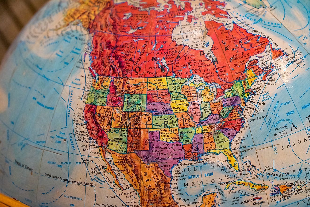
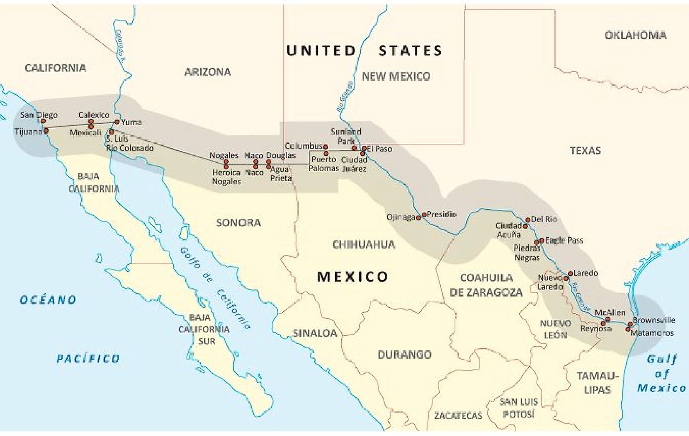
There are four states in the United States that share a border with Mexico: California, Arizona, New Mexico, and Texas. Each brings its own story, geography, and cultural identity to the table. Whether you're planning a road trip, researching geography, or just curious, here’s a deep dive into each of these states and what makes their connection to Mexico so unique.
California

-
Length of border with Mexico: 140 miles
-
Key border cities: San Diego, Calexico
-
Main Mexican counterpart cities: Tijuana, Mexicali
-
Landscape: Pacific coastline, mountains, and desert
California’s border with Mexico may be the shortest of the four, but it is one of the most heavily traveled. The San Ysidro Port of Entry, which connects San Diego with Tijuana, is the busiest land border crossing in the Western Hemisphere. Each day, tens of thousands of vehicles and pedestrians move between these two cities.
Southern California’s border region is defined by contrast. On one side: the vibrant beaches and tech-driven economy of San Diego. On the other: Tijuana’s colorful energy and growing art scene. Inland, the Imperial Valley transforms into a desert expanse punctuated by agriculture fed by the Colorado River.
California’s borderlands also carry political weight. Immigration debates, border wall construction, and trade policies frequently make headlines here. Yet, despite the tensions, the border remains a lifeline for families, workers, and binational commerce.
Arizona

-
Length of border with Mexico: 372 miles
-
Key border cities: Nogales, Douglas, Lukeville
-
Main Mexican counterpart cities: Nogales, Agua Prieta, Sonoyta
-
Landscape: Sonoran Desert, mountain ranges
Arizona’s border with Mexico runs through some of the most visually stunning desert terrain in North America. Cactus-covered hills, jagged mountains, and wide, open skies define the landscape. But within this arid zone lie several key crossing points and towns steeped in cultural heritage.
Nogales, Arizona, and its Mexican twin, Nogales, Sonora, are separated by a steel fence but are connected in every other sense. The communities share families, businesses, and a history that predates the border itself. Further east, the city of Douglas faces Agua Prieta, forming another binational pair.
Arizona is also home to significant Native American land, including the Tohono O’odham Nation, whose ancestral territory spans the current international border. This unique situation presents ongoing challenges related to travel, identity, and cultural preservation.
From a geographic standpoint, Arizona offers a raw and beautiful look at the desert Southwest. But politically and socially, the state sits at the crossroads of national debate.
New Mexico

-
Length of border with Mexico: 179 miles
-
Key border cities: Columbus, Sunland Park, Santa Teresa
-
Main Mexican counterpart cities: Palomas, Ciudad Juárez
-
Landscape: High desert, grasslands, mountain foothills
New Mexico’s border with Mexico is shorter and more remote than its western and eastern neighbors, but it’s no less fascinating. This stretch of land offers historical sites, small-town charm, and plenty of natural beauty.
The village of Columbus is one of New Mexico’s main border crossings and has a unique claim to fame. In 1916, it was the site of a cross-border raid by Mexican revolutionary Pancho Villa, prompting a US military response led by General John J. Pershing. Today, the border crossing at Columbus connects with the town of Palomas, known for its shopping and tourism.
The western edge of the border near Sunland Park sits just outside of El Paso, Texas, and shares proximity with the Mexican metropolis of Ciudad Juárez. Although New Mexico's border towns are smaller and quieter, the region plays a key role in cross-border trade and infrastructure, particularly through the Santa Teresa industrial zone.
New Mexico’s desert plains, dotted with volcanic rocks and mesas, create a hauntingly beautiful backdrop for a border that often flies under the radar.
Texas

-
Length of border with Mexico: 1,254 miles
-
Key border cities: El Paso, Laredo, McAllen, Brownsville, Eagle Pass
-
Main Mexican counterpart cities: Ciudad Juárez, Nuevo Laredo, Reynosa, Matamoros, Piedras Negras
-
Landscape: Rio Grande river valley, brushlands, mountains, coastal plains
Texas boasts the longest stretch of border with Mexico, more than all the other states combined. It is also home to some of the busiest and most historically significant border crossings in the United States. From west to east, Texas and Mexico meet along the path of the Rio Grande, a river that shapes the geography and culture of the entire region.
In El Paso, the desert meets the mountains, and the city melds with Ciudad Juárez across the river. This bustling metro area is one of the largest binational communities in the world. Further along, cities like Laredo and McAllen are economic engines fueled by international trade. Laredo is the top port of entry for US-Mexico trade, surpassing even larger coastal ports in volume.
Downriver, Brownsville meets Matamoros at the Gulf of America. This area is known for its coastal wetlands, subtropical climate, and cross-border relationships that defy political narratives.
Texas's long border means it experiences nearly every aspect of the border story, from immigration and commerce to culture and conflict. Its landscape also shifts dramatically, from the mountains near Big Bend National Park to the humid farmland of the Rio Grande Valley.
Why These Borders Matter

The US-Mexico border is a subject of global attention, but too often it is viewed only through the lens of politics. What’s frequently overlooked is how deeply interwoven the lives, economies, and landscapes are across these four states and their Mexican counterparts.
More than just lines on a map, these borders are zones of cultural fusion. Spanish is commonly spoken on both sides. Food, music, and traditions blend in a way that creates a regional identity all its own. Families cross frequently to shop, work, and visit relatives. Trade crosses daily in the form of goods that end up on shelves across the country.
Understanding which US states border Mexico means understanding a key part of American geography, history, and identity.
Final Thoughts

So, which US states border Mexico? Just four, but what they lack in number, they more than make up for in complexity, beauty, and influence. From the Pacific to the Gulf of America, these states form a southern boundary that’s alive with history, shaped by geography, and driven by the rhythm of life on both sides of the border.
Whether you’re studying maps, planning your next adventure, or simply want to understand a little more about the fabric of America, these border states tell a story you won’t find anywhere else.
Chart: US States That Border Mexico
| State | Length of Border | Notable Border Cities | Key Features |
|---|---|---|---|
| California | 140 miles | San Diego, Calexico | Coastline, desert, Tijuana border crossing |
| Arizona | 372 miles | Nogales, Douglas, Lukeville | Sonoran Desert, binational communities |
| New Mexico | 179 miles | Columbus, Sunland Park | High desert, historical sites |
| Texas | 1,254 miles | El Paso, Laredo, Brownsville | Rio Grande, trade hubs, long border |