Snake River
Winding for more than 1,000 miles through rugged canyons, vast plains, and dramatic volcanic landscapes, the Snake River is one of the most powerful and essential waterways in the western United States. As the largest tributary of the Columbia River, it is not only vital to regional agriculture and hydroelectricity but also plays a key role in the culture, recreation, and natural heritage of the Pacific Northwest.
From its alpine origins in Wyoming to its confluence with the Columbia in Washington, the Snake River tells a story of geologic wonder, human innovation, and ecological complexity that continues to shape the American West.
Headwaters in the Rockies

The journey of the Snake River begins high in the Rocky Mountains near the southeastern corner of Yellowstone National Park. Born from the snowmelt and runoff along the Continental Divide, the river flows southward through Jackson Lake and hugs the eastern base of the majestic Teton Range in Grand Teton National Park. This upper stretch is known for its pristine beauty and is a popular destination for fishing, rafting, and wildlife viewing.
After swinging northwest near the mouth of the Greys River, the Snake enters Idaho via the Palisades Reservoir, a high mountain basin ringed by steep forested slopes. Here, the waterway begins to build volume as it merges with tributaries fed by snowpack from surrounding states.
Across the Snake River Plain

Just downstream of Heise, Idaho, the Snake River exits the mountains and carves a wide path through the vast and otherworldly Snake River Plain. This broad stretch of southern Idaho is characterized by volcanic rock, ancient lava flows, and a landscape shaped by violent eruptions thousands of years ago.
Although seemingly barren, the Snake River Plain is a crucial agricultural zone. The upper Snake River above King Hill is heavily used for irrigation, supplying water to countless farms and ranches. Massive infrastructure projects—including the American Falls Dam and Reservoir—regulate water levels for both agriculture and hydroelectric power, supporting everything from potato farming to industrial manufacturing.
The fertile soils of the plain, combined with the availability of water, have helped make Idaho a leading agricultural producer. However, the region’s history also includes moments of crisis—most notably the 1976 collapse of the Teton Dam, which unleashed catastrophic flooding through the upper Snake River Valley.
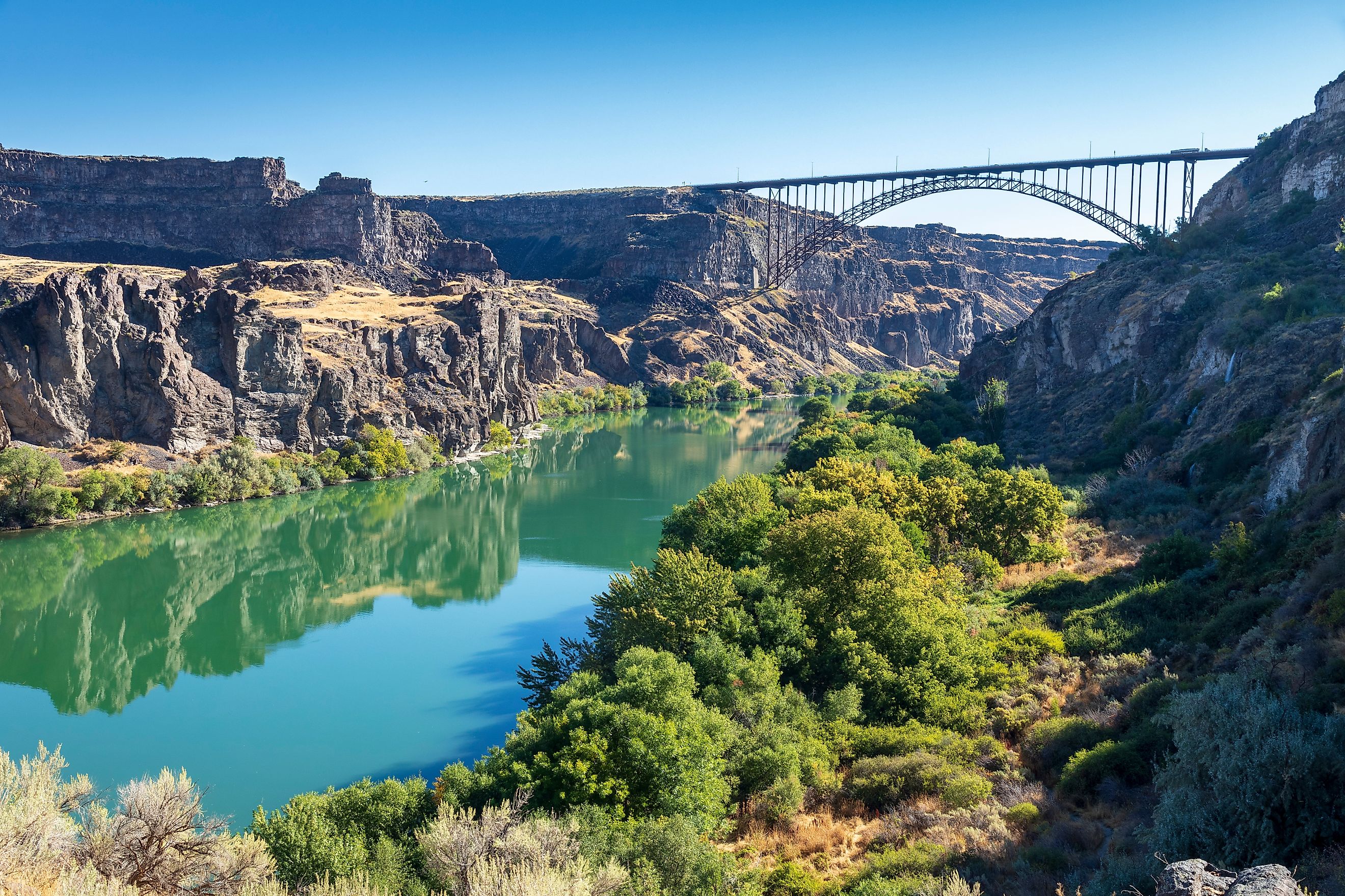
The Gorge and the Falls

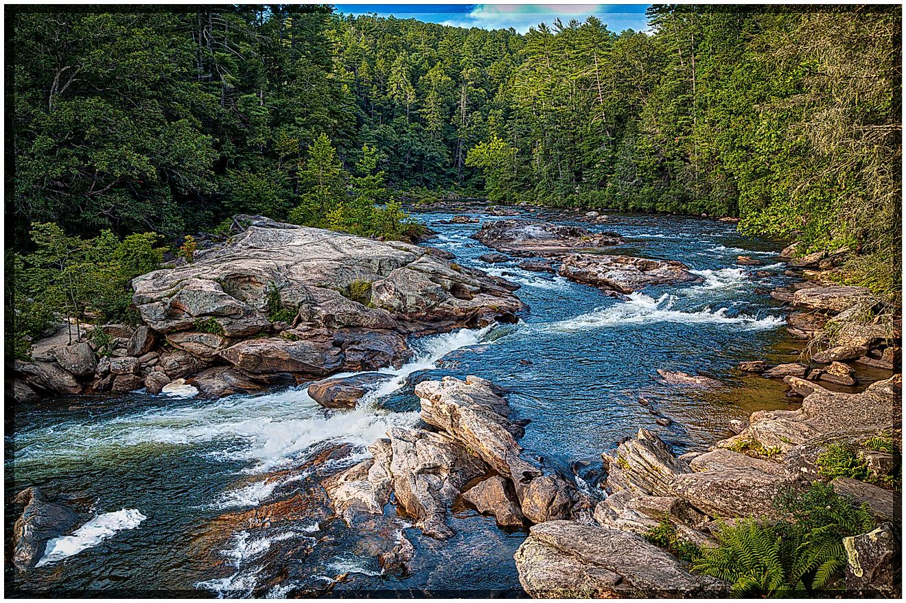
Among the river’s most dramatic features are its waterfalls and deep canyons. Near the city of Twin Falls in southern Idaho, the river drops over a series of stunning cascades. Twin Falls plunges 65 feet, while nearby Shoshone Falls, known as the "Niagara of the West," towers at 212 feet—higher than Niagara Falls itself.
These falls attract visitors from across the country and are a testament to the erosive power of the Snake River. Over millennia, the river has carved these features into the basalt layers of the Snake River Plain, creating natural landmarks that blend scenic wonder with geological significance.
Downstream, the river deepens into one of North America's most impressive natural gorges—Hells Canyon. Straddling the border between Oregon and Idaho, this section of the river flows through a canyon more than one mile deep. In fact, Hells Canyon is the deepest river gorge in North America, plunging nearly 8,000 feet in some areas.
A Vital Artery for the West

The Snake River is far more than a scenic waterway—it is a vital artery that supports millions of people across multiple states. The river’s drainage basin spans approximately 109,000 square miles, collecting runoff from Wyoming, Utah, Nevada, Idaho, Oregon, and Washington. As it descends from elevations over 10,000 feet to just 300 feet at its mouth, the Snake plays an indispensable role in regional water management.
In its middle stretch—from King Hill to Weiser, Idaho—the river is primarily used for hydroelectric generation. A series of dams harness the river’s flow, producing renewable energy for surrounding communities and industries. While irrigation in this section is often handled by tributaries like the Payette, Owyhee, Malheur, and Boise Rivers, the Snake itself remains a key resource for both energy and environmental planning.
The lower Snake River—extending from Weiser through Hells Canyon to its confluence with the Columbia—completes the river’s journey through remote wilderness and breathtaking terrain. Here, the river is fed by its largest tributary, the Salmon River, which merges near the end of Hells Canyon.
Recreation and Conservation

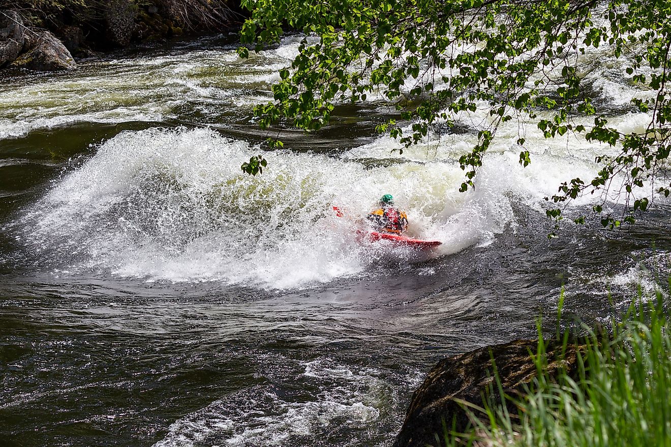
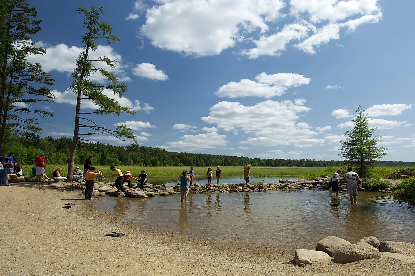
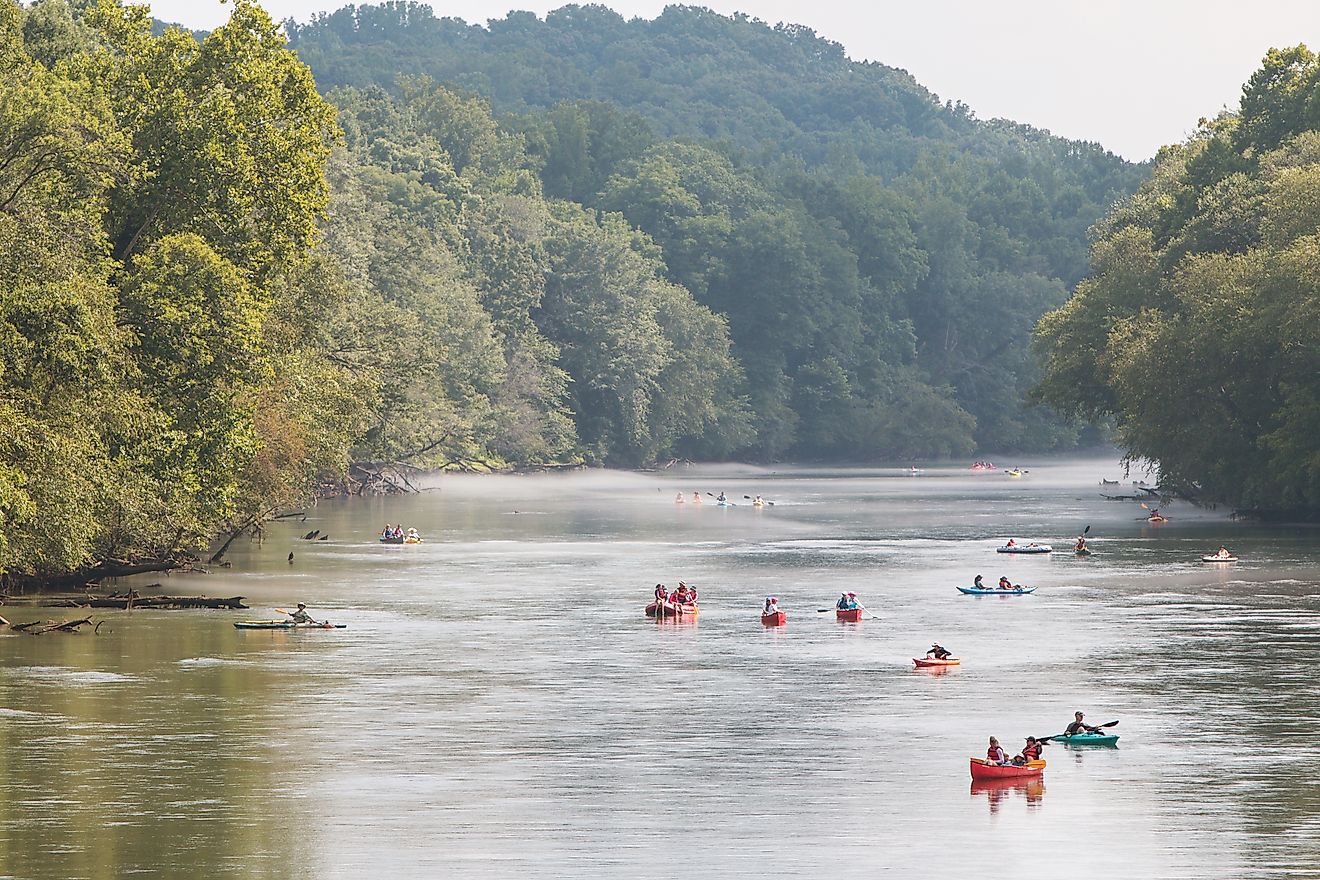
In addition to its practical roles, the Snake River is a beloved recreational destination. Anglers, boaters, hikers, and campers flock to various points along its course to experience the river’s untamed beauty and abundant wildlife.
Hells Canyon National Recreation Area offers one of the best places to explore the river’s rugged splendor. Covering over 650,000 acres across Idaho and Oregon, the area provides hiking trails, rafting trips, and panoramic views of the canyon’s sheer walls. Meanwhile, the Hagerman Fossil Beds National Monument in southern Idaho preserves some of the richest fossil deposits in North America, offering a window into prehistoric life along the river.
Further upstream, Grand Teton and Yellowstone national parks provide scenic river access in more alpine settings, with fishing and float trips that appeal to travelers looking for a mix of tranquility and thrill.
Conservationists and land managers continue to work on balancing the river’s ecological health with human demands. The Snake River supports a variety of ecosystems—from alpine meadows and riparian forests to high desert shrublands—and serves as a critical habitat for fish and migratory birds. Some stretches are designated as Wild and Scenic Rivers, ensuring long-term protection against overdevelopment.
Challenges and Controversies

Despite its natural beauty and utility, the Snake River faces mounting environmental challenges. Dams, irrigation, and agricultural runoff have altered the river’s flow and water quality in some areas. Salmon populations, once abundant in the Snake and its tributaries, have declined sharply due to obstacles in their migratory paths.
The ongoing debate over dam removal, especially in relation to endangered fish species and tribal fishing rights, has sparked national conversations about how to manage the river’s future. Environmental advocates argue that restoring the Snake’s natural flow could help revive declining ecosystems, while others stress the importance of hydropower and water control in a changing climate.
In recent years, the Snake River has also become a focal point in broader discussions about water rights and access in the western United States, as states grapple with drought, development, and conservation priorities.
A River of Stories

Beyond the science, industry, and recreation, the Snake River holds deep cultural significance. Indigenous peoples, including the Shoshone, Nez Perce, Bannock, and Paiute tribes, have lived along the river’s banks for thousands of years. The Snake’s name is believed to originate from a misinterpretation of a Shoshone hand gesture that mimicked the movement of swimming fish.
The river also played a critical role during westward expansion, serving as a route for fur traders, explorers, and pioneers on the Oregon Trail. Today, towns and cities along the Snake—such as Idaho Falls, Twin Falls, Lewiston, and Pasco—carry on the legacy of this historic waterway.