The 8 States That Make Up The Rocky Mountain Region
The Rocky Mountains create one of the most recognizable geographic backbones in North America. Peaks rise sharply across thousands of miles, carving valleys, feeding rivers, shaping climate, and influencing the history of everything around them. The region stands at the center of countless stories about exploration, wildlife, national parks, boomtowns, outdoor culture, and the constant pull of high country adventure.
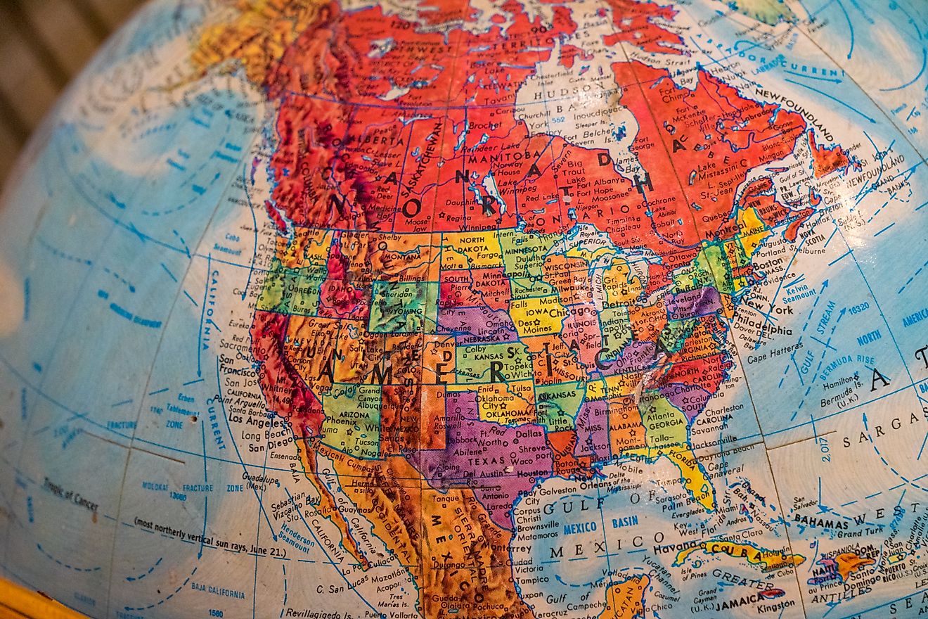
The Rockies stretch much farther than the postcard scenes of snow-capped ridges. The Rocky Mountain Region includes eight distinct states. Travelling across this region reveals alpine towns, desert edges, glacial lakes, broad plains, deep forests, and remote wilderness.
These eight states make up the Rocky Mountain Region, revealing how the mountains influence their landscapes and show why each one strengthens the region’s reputation as one of America’s most iconic travel territories.
The Rocky Mountain Region at a Glance

These eight states make up the Rocky Mountain Region and showcase the key characteristics that tie them to the influence of the mountains.
Rocky Mountain Region Overview
| State | Key Mountain Features | Notable Highlights |
|---|---|---|
| Colorado | Central Rockies, Front Range | Four National Parks, 14ers, ski culture |
| Wyoming | Absaroka, Wind River, Tetons | Yellowstone, Grand Teton, wide open land |
| Montana | Northern Rockies | Glacier National Park, vast wilderness |
| Idaho | Bitterroots, Salmon River Mountains | Sawtooths, whitewater culture |
| Utah | Wasatch, Uinta Mountains | National parks, high lakes, red rock meets high peaks |
| New Mexico | Sangre de Cristo Mountains | Adobe towns, desert and alpine blend |
| Arizona | Southern Rockies influence | San Francisco Peaks, high desert plateaus |
| Nevada | Great Basin ranges tied to the Rockies | Basin and Range topography, alpine islands |
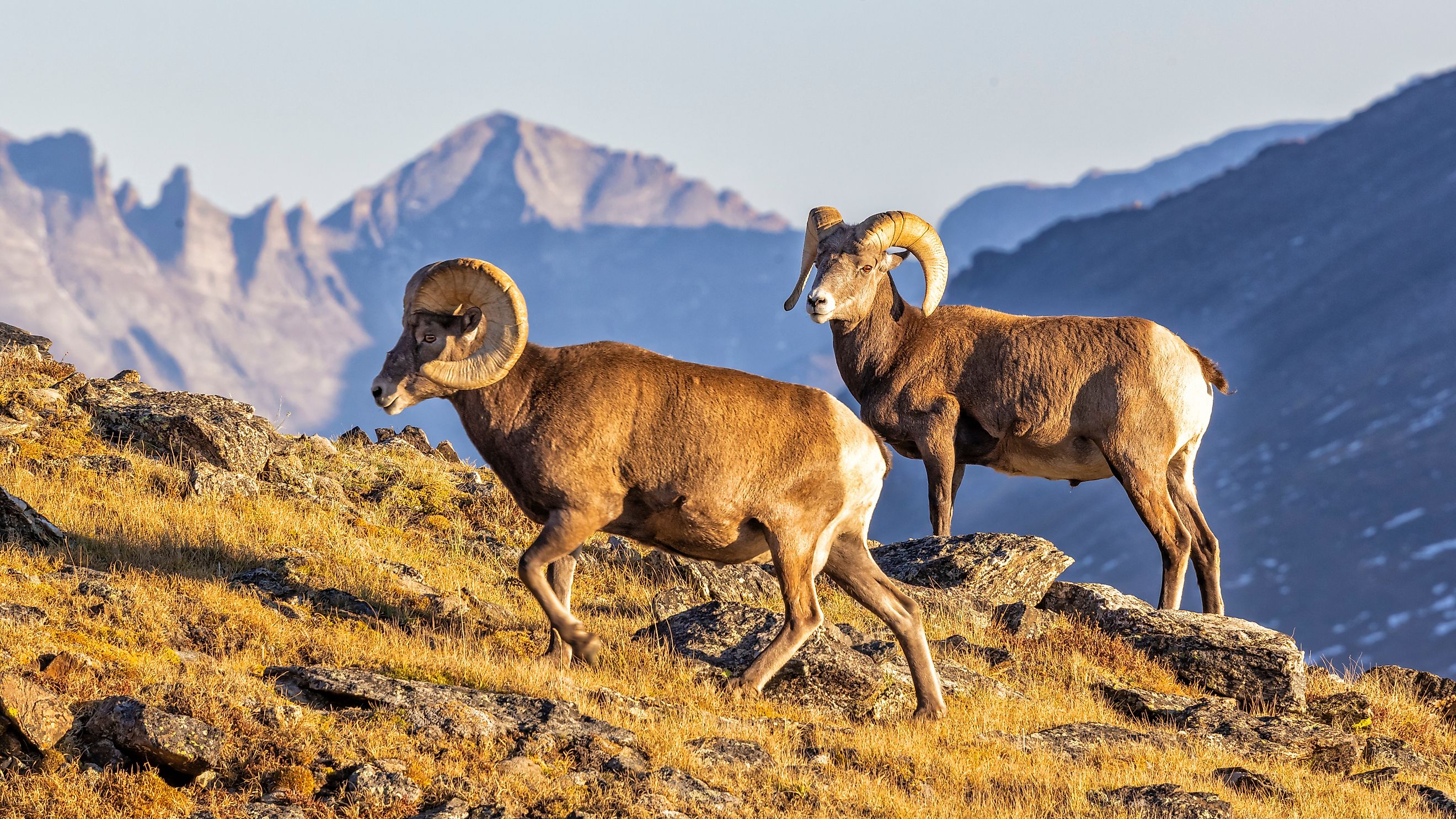
Colorado

Colorado stands at the heart of the Rocky Mountain Region. The range shapes the state’s geography, identity, and rhythm of life. Forty peaks rise above 14,000 feet, the highest concentration in the country. Those summits influence everything from weather patterns to river systems to long established outdoor traditions.
Denver anchors the eastern edge of the Front Range, and the landscape shifts quickly as the road moves west. Ski towns, historic mining communities, and broad stretches of national forest create a chain of high elevation destinations. Mountain passes that once challenged wagon travel now draw steady traffic over scenic routes lined with meadows, clear lakes, wildlife, and dramatic alpine ridges.
Colorado’s relationship with outdoor recreation fuels much of its current momentum. Skiing, hiking, mountain biking, climbing, rafting, and camping support a thriving lifestyle economy. Four national parks strengthen that appeal, especially Rocky Mountain National Park, which continues to draw millions each year.
Wyoming

Wyoming offers some of the most striking mountain scenery in the country. The state’s northwestern corner rises into the Tetons, a skyline that towers above the Jackson Hole valley and draws climbers, photographers, and wildlife watchers from around the world. The Wind River Range delivers another legendary stretch of high country, filled with granite walls, deep basins, and glacial lakes that feel far removed from everyday noise.
Yellowstone National Park and Grand Teton National Park shape much of Wyoming’s global reputation. These protected landscapes support sweeping wildlife corridors for bison, wolves, elk, and bears. Thermal features in Yellowstone shift and steam with a constant reminder that the region sits over a powerful geological hotspot.
Wide open land adds to Wyoming’s identity. Long distances between towns create a sense of freedom that many connect with the state’s frontier past. Ranching traditions, Indigenous history, and the routes once taken by early explorers all contribute to a culture built around resilience and connection to the land.
Montana

Montana pushes the Rocky Mountain Region into the far north, where the Northern Rockies carve deep valleys, jagged cliffs, and some of the wildest stretches left in the Lower 48. Glacier National Park shines as the state’s crown jewel, with alpine lakes, soaring passes, and the iconic Going-to-the-Sun Road winding through breathtaking scenery.
The park preserves landscapes shaped by ancient glaciers. Turquoise waters sit below steep peaks, and mountain goats navigate narrow ledges above trails like Iceberg Lake and Grinnell Glacier. Snow lingers on the highest summits well into summer, keeping the mountains fresh and rugged year-round.
Montana’s sheer scale sets it apart. Towns are far apart, and wilderness dominates much of the state. Forests, prairies, and river valleys merge into ecosystems that support grizzlies, wolves, elk, and herds of deer. Small mountain communities thrive on a balance of solitude and traditions rooted in ranching and logging.
Idaho

Idaho brings some of the Rockies’ most rugged and often overlooked mountains. The Bitterroot Range and Salmon River Mountains slice across the state, creating dramatic ridges and winding canyons. The Sawtooth Range stands out for hikers and paddlers, its sharp granite peaks and linked alpine lakes glinting under the summer sun.
The state’s central interior holds millions of acres of public land, with rivers carving paths through remote wilderness. The Salmon River, nicknamed the “River of No Return,” flows through landscapes that feel completely untouched. Towns along the Payette and Salmon Rivers thrive on whitewater adventure, making rafting a defining part of Idaho’s outdoor culture.
Idaho’s combination of mountains, lakes, and forests adds a sense of hidden wildness to the Rocky Mountain Region. Travelers expecting nothing more than potato fields often find towering peaks that deserve a spot in any conversation about America’s most dramatic landscapes.
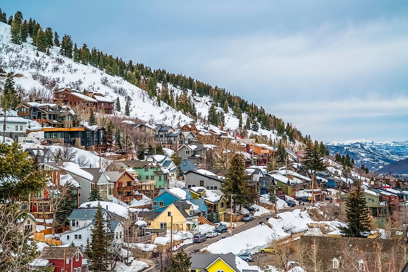
Utah

Utah is known for its red rock deserts, deep canyons, and iconic national parks, but its mountains play a central role in the Rocky Mountain Region. The Wasatch Range runs along the urban corridor, shaping Salt Lake City’s skyline and bringing heavy snowfall that supports a world class ski industry.
The Uinta Mountains add a unique twist. Running east to west, a rare pattern in North America, these ridges hold glacial basins and hundreds of clear alpine lakes that stand in striking contrast to the surrounding terrain.
The mountains also shape the desert below. Snowmelt feeds rivers that carve deep into stone, creating the dramatic canyons that define Utah’s national parks and connect the state’s alpine and desert landscapes in one breathtaking region.
New Mexico

New Mexico anchors the southern edge of the Rocky Mountains, where the Sangre de Cristo range rises dramatically above Santa Fe and Taos. Peaks tumble between desert, forest, and alpine terrain, creating a striking mix of landscapes that give the state its unmistakable character in the region.
High valleys are dotted with historic adobe towns, their earthy tones contrasting with snow-dusted slopes in winter. Ski resorts like Taos have turned these mountains into world-class destinations, offering steep runs and a deep-rooted mountain culture. Trails weave through pine forests and wildflower-filled meadows, opening onto overlooks that frame both jagged peaks and sunbaked desert plateaus in a single breathtaking view.
The mountains carry centuries of cultural history. Indigenous communities maintain a profound connection to these landscapes, while Spanish traditions remain alive in architecture, cuisine, and vibrant local festivals.
Arizona

Desert canyons and cactus forests dominate much of Arizona, but the state also stretches into the southern Rockies with high plateaus and towering mountain ranges. The San Francisco Peaks, north of Flagstaff, form the state’s tallest volcanic range, rising above 12,000 feet. Alpine forests cling to these slopes, creating a sharp contrast with the surrounding desert and providing habitat for species such as elk, black bears, and bald eagles.
The high country experiences heavy winter storms and cool summer temperatures, supporting a unique ecological system. Ponderosa pine forests cover vast portions of the Colorado Plateau, and numerous mountain lakes supply water for rivers and support trout populations. High meadows bloom with seasonal wildflowers, offering crucial forage for wildlife and a visual contrast to the rugged ridges and volcanic terrain.
Nevada

Nevada is often thought of as a desert state, yet long mountain chains stretch across its landscape, forming part of the greater Basin and Range province and linking the state to the Rockies. These ranges rise sharply between wide valleys, creating isolated pockets of alpine terrain that contrast sharply with the surrounding desert.
Great Basin National Park captures this high-elevation side of Nevada. Wheeler Peak soars above 13,000 feet, its slopes dotted with ancient bristlecone pines, glacial remnants, and clear mountain streams. The park also offers some of the darkest night skies in the country, adding another dimension to Nevada’s outdoor identity.
Small mountain communities in these ranges reflect the state’s history, shaped by ranching, mining, and long-standing rural traditions. These rugged, elevated landscapes highlight Nevada’s connection to the Rocky Mountain Region, offering a striking counterpoint to the arid basins often associated with the state.
A Region Shaped by Altitude, History, and Adventure

The Rocky Mountain Region stretches across eight states that each bring their own character to the mountains. Colorado delivers elevation extremes and a strong outdoor identity. Wyoming and Montana offer vast wilderness. Idaho shapes the region through rugged peaks and river culture. Utah, New Mexico, Arizona, and Nevada extend the Rockies into deserts, plateaus, and cultural crossroads that enrich the region’s story.
Together, these states create a massive landscape filled with variety, beauty, and history. The Rockies rise across all of them, forming one of the most dramatic and influential regions in the country. Travelers explore this part of America to experience high country adventure, breathtaking scenery, and cultures deeply rooted in the land. The region remains timeless, powerful, and endlessly compelling.