The Most Dangerous Rivers in America
Rivers are often seen as scenic getaways, the kind of places you go for fishing, rafting, or a peaceful afternoon by the water. But beneath the calm surface, some rivers in the United States hide a more treacherous side. Strong currents, deadly rapids, sudden flash floods, and underwater debris have turned these waterways into deadly hazards for even the most experienced adventurers.
Every year, people underestimate the power of rivers and pay the price. Whether it's a remote backcountry channel or a popular rafting destination, some rivers are simply not to be taken lightly. These seven rivers are notorious for their danger, responsible for fatalities, injuries, and countless rescues. They demand respect, preparation, and an awareness of the risks that lurk beneath their surface.
Kern River

Length: 165 miles
States: California
Dangers: Powerful currents, submerged boulders, cold water, steep canyon walls
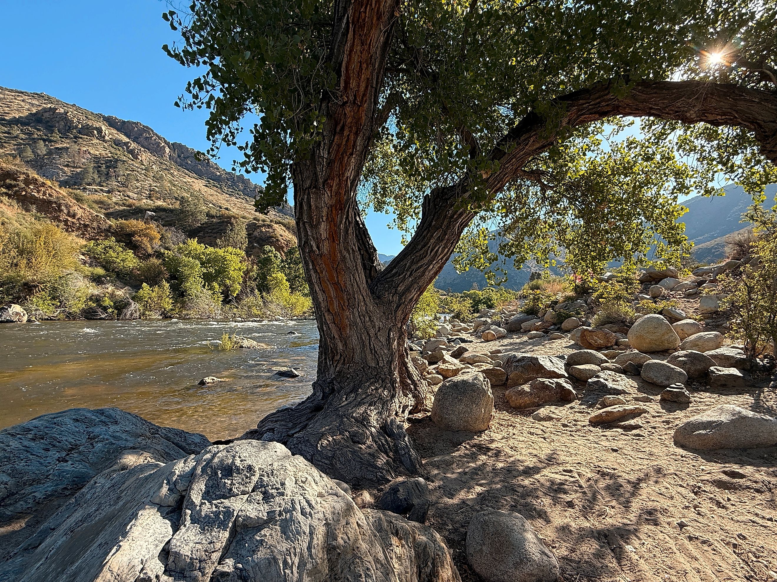
The Kern river slices through California’s Sierra Nevada with breathtaking beauty, but it carries a deadly reputation that overshadows its scenic appeal. Known by locals as the “Killer Kern,” this river has claimed more than 300 lives in the past few decades. It is a favorite for rafters, anglers, and hikers, but even experienced adventurers know the river can turn unforgiving in an instant.
The river’s crystal-clear waters hide powerful, unpredictable currents that can sweep swimmers and boaters downstream in seconds. Beneath the surface lurk jagged rocks and boulders, often invisible until it’s too late. Sudden surges from mountain snowmelt cause water levels to rise rapidly, increasing the strength of rapids and creating hazardous conditions. Cold water temperatures sap strength and can trigger hypothermia quickly, even in the summer months.
The narrow canyon walls confine the river, leaving little room for escape when trouble strikes. Rescue operations are challenging due to the remote and rugged terrain. Visitors are drawn to the Kern for its natural beauty, but its dangerous personality demands caution.
Cuyahoga River

-
Length: 100 miles
-
States: Ohio
-
Dangers: Pollution remnants, debris, strong currents, urban flooding risks
The Cuyahoga River may not roar with wild rapids, but its history is steeped in danger of a different kind. Once known as one of the most polluted rivers in America, the Cuyahoga gained national attention when it caught fire multiple times in the 20th century, most famously in 1969. This fiery legacy symbolized the environmental hazards lurking beneath its surface.
Today, the river has been cleaned up considerably, but its waters still conceal hidden risks. Industrial remnants and debris lie beneath murky sections, posing hazards to swimmers and boaters. Strong currents flow unpredictably through narrow urban channels, making navigation tricky. Flooding remains a threat during heavy rains, sending surging waters through the city and risking property and lives.
While the Cuyahoga is no longer the “river that burned,” its past reminds us that dangers in rivers come in many forms, not just from nature but from human impact.
Mississippi River

-
Length: 2,340 miles
-
States: Minnesota, Wisconsin, Iowa, Illinois, Missouri, Kentucky, Tennessee, Arkansas, Mississippi, Louisiana
-
Dangers: Strong currents, undertows, barge traffic, hidden debris, flooding
This iconic American waterway is one of the deadliest in the country. The Mississippi River is the second-longest river in the United States and cuts through the heart of the nation, flowing past major cities and countless rural communities. For many, it’s a symbol of commerce, history, and even romance. But beneath the surface, it hides a darker side.
The Mississippi’s vast width and steady flow conceal powerful undercurrents that can pull even experienced swimmers under without warning. The riverbed is unstable and constantly shifting, creating sudden drop-offs and hidden hazards like snags, tree limbs, and sandbars. Its water is thick with sediment, giving it a muddy, opaque quality that limits visibility and makes underwater dangers almost impossible to spot.
On top of that, it’s a major commercial corridor. Massive barges and freighters travel up and down the river daily, generating wakes and currents that can capsize small boats or sweep paddlers off course. Flooding is another serious threat. After heavy rains or upstream snowmelt, water levels can surge quickly and without warning, swallowing low-lying banks and pulling in debris.
The Mississippi’s reputation may be built on folklore and steamboats, but its reality is far grittier. Ask any rescue crew or river town local, and they’ll tell you this river is as dangerous as it is legendary.
Colorado River

-
Length: 1,450 miles
-
States: Colorado, Utah, Arizona, Nevada, California
-
Dangers: Class III to V+ rapids, cold water shock, flash floods, remote access
The Colorado River is famous for carving the Grand Canyon and offering some of the most thrilling whitewater rafting in the country. But its beauty masks serious dangers.
The rapids here are among the toughest in North America, with strong hydraulics and sudden drops that can overturn boats in seconds. The river stays cold year-round, often near 50 degrees Fahrenheit. Falling into the water can cause cold water shock, muscle cramps, and hypothermia quickly.
Much of the river flows through remote terrain with no easy access to help. Rafting groups must be self-reliant for emergencies. Flash floods from thunderstorms in nearby canyons can arrive without warning, flooding campsites and creating dangerous currents.
Some calmer-looking sections hide powerful undercurrents and swirling eddies that can trap swimmers or boats. Floating logs and submerged rocks increase the risks, especially during high runoff.
The Colorado River demands respect and caution. Its beauty comes with serious hazards that have caused injuries and fatalities every year. Anyone venturing here must be prepared for the river’s power and unpredictability.
Columbia Bar

-
Length: Approximate 7 miles (river mouth to ocean)
-
States: Oregon, Washington
-
Dangers: Shifting sandbars, powerful currents, violent waves, whirlpools, low visibility, sudden storms
The Columbia Bar, often called the “Graveyard of the Pacific,” is one of the most treacherous river mouths in the world. Located where the mighty Columbia River meets the Pacific Ocean, this shifting sandbar has swallowed countless ships and claimed many lives over the centuries. Powerful ocean waves collide with the river’s strong current, creating unpredictable, violent waters that challenge even the most skilled mariners.
The Columbia Bar’s shallow, shifting sands form sudden drop-offs and whirlpools that can trap vessels. Sudden storms and heavy seas quickly turn the passage deadly. Visibility often worsens due to dense fog and storms, making navigation a nightmare. Despite modern navigation aids and a famed Coast Guard rescue team, the bar remains a perilous spot where nature’s forces meet with devastating power.
Potomac River

-
Length: 405 miles
-
States: Maryland, Virginia, West Virginia, Washington D.C.
- Dangers: Powerful currents, hydraulic traps, slippery rocks, sudden flow changes, difficult rescue conditions
Winding through the heart of Washington, D.C., the Potomac River blends national symbolism with natural beauty. But this historic waterway hides a dangerous temperament, especially in the stretch near Great Falls, where it becomes one of the most hazardous rivers on the East Coast.
Here, the river narrows dramatically and drops through a series of jagged rock outcroppings, creating chutes, whirlpools, and powerful hydraulics that have claimed dozens of lives. Some currents are so forceful they can trap even strong swimmers beneath the surface. The river’s depth changes abruptly in places, with hidden ledges and steep underwater drops that aren’t visible from above.
On shore, the dangers continue. Slick, algae-covered rocks near the edge are a common cause of falls, and even shallow-looking pools can turn into roaring torrents after a storm. Rescue operations are extremely difficult in this section.
Despite warning signs and regular patrols, the Potomac’s deceptive beauty draws hikers, photographers, and paddlers every year.
Merrimack River

-
Length: 117 miles
-
States: New Hampshire, Massachusetts
-
Dangers: Rapid flow changes, submerged debris, hidden drop-offs, undertows near dams, cold water temperatures
The Merrimack River flows through New Hampshire and Massachusetts, winding its way past cities, forests, and industrial sites. While it may seem calm in some stretches, this river has a hidden edge. Rapid changes in water flow combined with industrial history have made it hazardous for swimmers, boaters, and fishermen.
The Merrimack’s currents can shift quickly, especially during heavy rain or dam releases, catching people unaware. Some sections have submerged debris, old mill foundations, and hidden drop-offs that create treacherous conditions. Water pollution and cold temperatures in certain areas increase health risks. Strong undertows near dams and narrow channels have contributed to fatal accidents over the years.
Final Thoughts: When Rivers Turn Deadly
These rivers might be breathtaking, but their beauty often hides a dangerous reality. Strong currents, cold shock, and hidden hazards make them deadly for the unprepared. Whether you're rafting, kayaking, fishing, or just hiking nearby, it’s crucial to respect these rivers. Know the risks. Check the weather. Use the right gear. And never go alone.
Fatalities happen every year, and in many cases, they are avoidable. The power of a river should never be underestimated. Some of the most tragic stories come from people who thought they were only stepping into a calm stream.
If you’re heading to any of these rivers, plan carefully. The water is not just a playground, it’s a force of nature.
The 7 Most Dangerous Rivers in America
| River | Length | States | Dangers |
|---|---|---|---|
| Kern River | 165 miles | California | Powerful currents, submerged boulders, cold water, steep canyon walls |
| Cuyahoga River | 100 miles | Ohio | Pollution remnants, debris, strong currents, urban flooding risks |
| Mississippi River | 2,340 miles | Minnesota, Wisconsin, Iowa, Illinois, Missouri, Kentucky, Tennessee, Arkansas, Mississippi, Louisiana | Strong currents, undertows, barge traffic, hidden debris, flooding |
| Colorado River | 1,450 miles | Colorado, Utah, Arizona, Nevada, California | Class III to V+ rapids, cold water shock, flash floods, remote access |
| Columbia Bar | Approx. 7 miles | Oregon, Washington | Shifting sandbars, powerful currents, violent waves, whirlpools, low visibility, sudden storms |
| Potomac River | 405 miles | Maryland, Virginia, West Virginia, Washington D.C. | Powerful currents, hydraulic traps, slippery rocks, sudden flow changes, difficult rescue conditions |
| Merrimack River | 117 miles | New Hampshire, Massachusetts | Rapid flow changes, submerged debris, hidden drop-offs, undertows near dams, cold water temperatures |